17 Jan 2016

Marin Trail, Snowdonia

Length:   25km
Climb:    450m
Grade:    Red
Time:     2 -4 hrs
Rating:   4/5

A new year and time to get back on top of my blog...

In September I had the pleasure of completing the marin trail at Penmachno. It is one I have always wanted to do and I wasn't disappointed.

It feels very much a natural trail at heart and there are some very interesting sections, including a hike a bike part, which had my entire party confused temporarily. It also has the charm of a true classic with some wide open double track sections and plenty of km to cover.

The final descent is good and long. A thin ribbon, winding down the hillside but the middle descent is by far the best section. Rough, rock strewn; and every bit a challenge to maintain momentum through the whole section. Clearing it fast was a whole heap of fun.

As much as I enjoyed individual bits of the first half of the route, much of my time was spent stop/start constantly waiting for others in the group to catch up. As such, I was beginning to think the trail didn't flow particularly well but, feeling slightly fed up, I pushed on through the second half and felt far more comfortable with the trail.

The rise and fall isn't that much of a hardship if you're fit. The climb out of the car park is pretty long but never really that steep. It is mainly fire road and easy rolling, and is preceded by a nice little taster ribbon of singletrack countouring the hillside for about 1km. Perfect for getting those legs nice and warm before the treadmill turns skywards.

At the top, great views (although better to come) and a descent, naturally. Not long but great nonetheless. It offers a fast paced down-bit racing through the pine wooded hillside.  The trail is made up of hard packed earth with a generous dusting of loose slate gravel, a lighter dusting of needles and plenty of rocky outcrops.

The first descent is not a hugely technical challenge, nor is the final descent for that matter. Both are probably red grade but mainly due to the less manicured trail surface over any particular obstacles (jumps/drops etc do not feature highly throughout this trail). The faster you ride, however, the more technical the challenge.

The middle descent is really where it's at; I believe labelled 'Dragon's Tail' on the trail card. Rough and rock strewn but, rather than loose rock /gravel, this section traverses upturned strata buried deep in the ground, the ends exposed creating an unforgiving, jagged surface. It's roll-able, don't get me wrong, but still requires good concentration to maintain a good pace and clear well, and fast.  It's a good km or more in length and is a particular highlight.

The views that precede it though. Oh my. Beautiful... Undulating landscape more pronounced than the hills of Herefordshire, with mountains stretching towards the sky beyond; the foreground, a beautiful lake and plenty of woodland. The colours completing a full palette from the greens and blues of the lake and woodland and the bright orange of the odd dying tree.

Anyway, I digress. The trail continues, following a long fast double track for a short while, covering a km or so, followed by the hike-a-bike section where the trail scales an unrideable set of steps. It threw us for a while but the trail does continue, passing through denser woodland with more needle titter, emerging eventually alongside the lake we were overlooking at the top of the first climb much earlier.
 

Another climb follows (this trail does go up and down) that brings you back to the top of the hill ascended first, crossing the fireroad at the top of the hill before embarking on the final descent. This was great fun as the trail snakes its way down the hill, the noise of my colleagues rattling behind me spurning me on. Corners were, aside from two sharp switchbacks, open and gentle allowing speed to rise and the rocky surface offering quite good grip.

Halfway down there's a nice new section, offering the briefest of 'trail centre' style big berms and jumps were perhaps more accustomed too nowadays but the natural surface resumes to see you to the car park.

I arrived at the car par with a big grin on my face. I can't wait to come back and attack the trail from the beginning.

Dragon's Back, Coed Y Brenin

Length:   25km
Climb:    450m
Grade:    Red
Time:     2 -4 hrs
Rating:   3.5/5

Classic at heart - venturing out into the picturesque mountainous countryside - but with plenty of very good, and technical, singletrack elements.

Dragon's Back is one of the jewels of Coed Y Brenin and does share some sections of trail with MBR. Particularly the final descent. It does segregate though, and carve it's own path in to the surrounding hills and valleys.

Starting at the shared gate adjacent to the visitors centre you embark by passing through a large set of sculptural suspension forks. the trail immediately lets you know what's in store with its characteristic boulder fest; yard after yard of well placed rocks - the trail is anything but smooth.

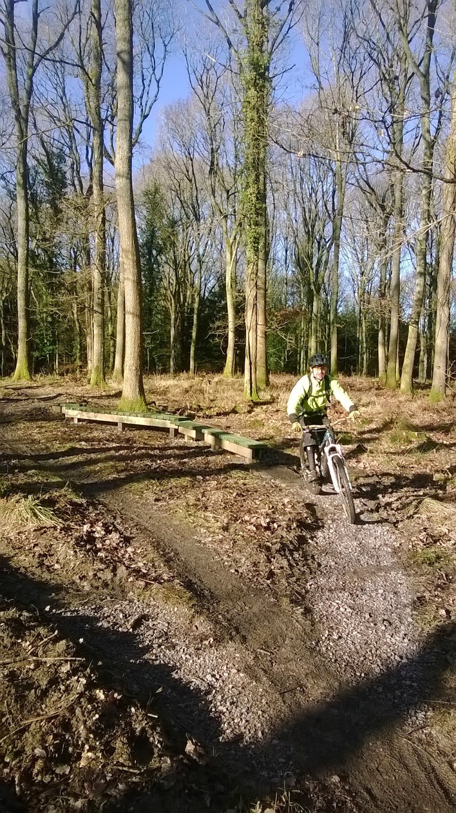
After a good kilometer or so, following a brief rise in elevation, the route eases off to hard packed earth (with a smattering of exposed rock patches to keep you on your toes) and the trail heads downwards. Speed ramps up and one is treated to the first real, flowing descent of the day. You don't loose a massive amount of elevation but the distance covered is fair and with gravity on your side the fun factor is immediate. The descent ends with some nice bike park style surfaced berms [pic].

But, the inevitable does happen and you do have to go up. A long climb ensues.  The farthest most point of the trail, around the tail of the dragon did feel slightly tedious and, dare I say, pointless. Mainly all fire road with altitude gained and wasted in equal measure. It felt a little like a tool to help increase the distance but what follows puts all thought of wasted elevation and pointless fire road right to the back of your mind.

A couple of singletrack sections (Hermon for example) break up the monotony of the double track but it was this portion of the trail that gives Dragon's Back its classic and remote character. The tail section does have one major selling point; opening out above the tree line upon some wondrous views across Snowdonia National Park. A major bonus for the effort exerted to get there.

The loss in altitude that follows seems a shame, initially. Hurtling down fire road is never a great way to descend a hillside but it does level off and, eventually, leads to some very very good trail. 'Gomez' to 'Uncle Fester' just flow, are fast and offer a very engaging technical challenge.

Singletrack the entire way, a good 3 or 4km of downness is split only by the ascending fire roads in to 5 or 6 chunks, but the fire road does little to really slow you down. The descent also incorporates sections of the traditional rock slab trail surface common to Coed Y Brenin and with its testing gradients to boot it provides a proper roller coaster feel, particularly 'Lurch'.

After a brief interlude, the ride opens out at the bottom of the hill. You pass along the bi-directional link and then there are two options, complete the trail with a final (long) climb or head back to the trail head along the public road. We opted for the climb but with a slight tinge of panic as the day was fading and the sun was getting low.

The climb is fire road and slowly winds its way back to a pretty fair height. It is best taken at a modest pace and use the time to chat with your riding buddies. It can lull you in to thinking you've reached the top with its mini crests but the rise keeps going. Once, finally, at the top take time to have a break too as the descent that follows leads all the way back to the trail head and gets pretty full on in places with very rooty/rocky trail surface.

Coed Y Brenin has an absolute myriad of trails to explore and Dragon's Back is a great trail. I would certainly like to try some of the black trails but this red graded loop was worth the effort, just. Whether I would recommend over others, only time will tell; better to just spend a few days here and try them all.

With such great facilities there seems very little reason not to spend a few days here. The trail centre itself has everything you'd need for the day. Great cafe, workshop, toilets/showers etc. There are also plenty of places offering accommodation, so get booked up and get riding.


29 Apr 2015

Cafall Trail, Cwm Carn

Grade: Red
Distance: 15.5km

Elevation: 795m
Time: 2 hours

Rating: 3.5/5


Challenging climbs and some quality descents but far too many stiles. They break up the trail too much and ruin the flow (although I suppose it's no worse than having to open a gate - btw I hate that too).

The first 1-1.5km of this route shares the same trail as its older brother, the Twrch. Splitting at the gate house for the forest drive and heading off up the opposite side of the valley. It also shares a similar rocky character to the Twrch over much of its length, although this is not exclusive and does diversify in the wooded at the peak of the climb; becoming quite earthy.

With this in mind it is worth highlighting that due to the prevailing character, like its brother, the Cafall will ride pretty well in wet or dry (I have tried both) but due to a distinct lack of detritus, the earthy top sections are definitely better in the dry - they become pretty slippy in the wet.

The trail is somewhat dominated in the early stages, not unlike Twrch, by a fairly hefty climb. There are no severe gradients to deal with. Just a single, drawn out and slightly undulating climb - but it keeps on going for quite some time and partly explains the number of uphill pics and lack of downhill ones, sorry.


During the climb, you are treated to a couple of brief interludes, one being a quick fire descent in to a small hairpin gulley with flowing stream but, over the short bridge, the climb continues. The second, about 2/3 of the way up, by a short fire-road section before entering the wooded, and earthy, top section.


The following descent only drops about a third of the gained altitude but is super fun with a tight but flowing, wooded trail; navigating around the trees like precision engineering. With a markedly steep earth bank rising to your side, there are plenty of apexes that are just willing you to strike a pedal to throw you off. It could be quite intimidating for some but with some conviction you can get a real buzz here. A final rocky chute spits you out in to the open and the trails heads to another climb section.  

This section is similarly tight and twisty climbing to roughly the same altitude that has just been lost. Once at the top however, bar a single, very steep 20 yard interruption, the route is all down from here on in.

Cafall, much like Twrch, is essentially one big up and one big down. The descent, however, unlike Twrch is compartmentalised in to three consecutive sections. Not broken by small inclines or natural features unfortunately but, instead, by man made stiles that define the start/end of each - a feature present on many of the welsh trail centres. I think one reason for their presence is simply to provide some respite on the descent and to temper enthusiasm in lesser skilled riders, as the cumulative speed and technicality could become taxing over an extended spell. These styles are irritating to be frank as they limit the trail from gaining flow for any real sustained period.  Sure the individual sections area fun but together they would be awesome.

The upper most part starts on mud trail. Tight and twisty as before but this soon gives way to pine littered bedrock - the rocky character so typical of much of the trail, and this part of wales, in general. If you've ridden Twrch, then you'll know what to expect. The trail is a bit more open than Twrch but harbors a few more switch backs, which slow the pace down. It is hard to replicate the kind of speed achievable coming down the final section on Twrch but this trail is as much fun. Current design seems to favour big berms and flow rich trails and this is evident here and the tight, twisting upper sections provide a definite variety in trail conditions.


The final part is a fairly tame section back to the car park but Cafall links so nicely on to Twrch that I rarely bother with it. Instead, by completing Twrch in the same ride, you get the original (and proper), final descent to the car park; and that is the best way to do it.

When I wrote up about Twrch ( link here) the trail centre was undergoing some changes. The car park was improved and an additional toilet/washing facilities building was added in the car park area. This has now opened, together with a small bike shop and workshop for trail repairs. The shop is actually an approved servicing centre for certain shocks and forks, so you can double up and catch a ride whilst the can is serviced.

Cwm carn has become a particular favourite of mine over the last 12 months or so, partly because of the location to me and secondly because of the growing variety of trail. But also, the facilities are great and ever improving. It is a great place to ride.

24 Feb 2015

Guiting Power

Distance: 28.5km
Climb: c.450m
Grade: Red
Rating: 3/5

"good, solid route, of classic style, with plenty of visual and technical stimulation to warrant investment of time and energy"

This route is not particuarly demanding, yet it is a ride typical of its Cotswold setting. The starting point is already high up in the Cotswold Hills and therefore there is not the grand opening climb one might expect when tackling a well-known range of hills or a classic route or the expectant 'final descent' so typical of modern trail centres. With the exception of the escarpment running northeast-southwest, the Cotswolds are not peaky mountain but rolling high wolds. The trail itself is adapted from the route as described by Tom Fenton in his Cotswold mountain biking guidebook.
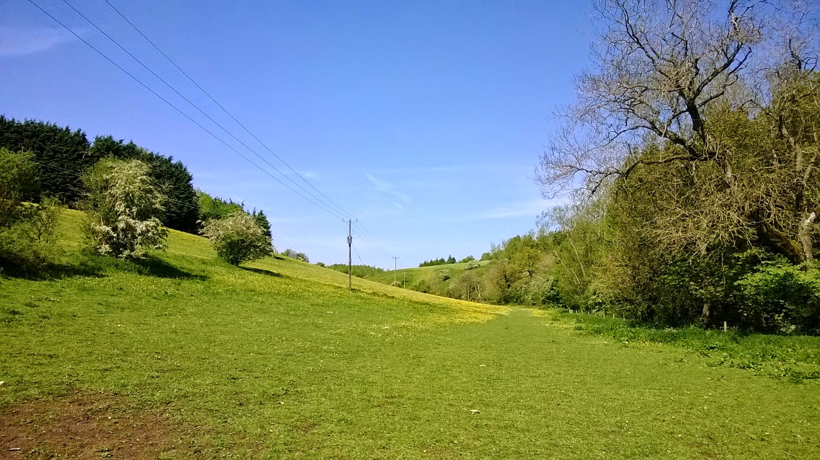
"we came down there and now we're heading up there" (Mint Sauce), mirroring the natural landscape in which it is set, this route has a rolling character of continuous short climbs and descents. Following a quick uphill blast out of Guiting Power village and a gentle warm up along a country lane, the route diverts on to farm land and heads downhill through long grassy fields  - a quick road jaunt at the bottom leads you to a stony track that follows the river Windrush before heading uphill and away from the stream.

This section of the ride is very tranquil and a beautiful part of the trail. Emerging from the woods the route crosses further open fields, this time inhabited by sheep (and sheep eggs, as someone kindly pointed out on the cleave hill post - if you don't like getting dirty I suggest you give up mountain biking) - happily grazing away and keeping the natural singletrack well defined.
The trail leads to the village of Upper Slaughter, revisiting the river bank of the Windrush. Head straight through the village and out along a tarmac lane (approx 1km) until you reach the byway finger pointer - head up the stony double track, taking time to admire the wildflowers that decorate the verges and the bees that service them, before reaching the brow of the hill and heading back down the other side. Descending along trail, adjacent to tall bramble hedgerows before entering a pine copse and arriving back at the river Windrush again at Aston House.


Head uphill and look for Aston Farm. Pass through the farmyard and follow the singletrack across the field and in to the woods. The following 2-3km of singletrack is my second most enjoyable part of the ride. It weaves sinuously around the trees like slalom posts and undulates up and down like a roller coaster. On a dry day it really flows quite well eventually emerging adjacent some heavily overgrown scrub land and  heading in to one of the quicker descents of the ride (although short), finishing at the bank of the river Windrush, again.
It is the most flowing and thrilling section of the ride from a pure riding perspective. As good as it is, however, it doesn't match sections of Bredon hill or Cleeve hill for both duration or technicality.  Nevertheless it is there to be attacked and enjoyed and certainly adds to the overall content of this route.

Follow the Windrush for 1 or 2 km along the Holst way before crossing the river and heading up a steep climb and around the back of a local golf course, followed by another descent - the trail leading in to and out of the village of Naunton. The long road climb that follows is a drag but eventually becomes a stony track and leads in to quarry country. The trail leads past the quarry works before eventually leading in to the fastest and longest descent of the route down a fairly rocky chute of trail, the ending section prior to emerging on to the road is probably the most technical.

A road blast takes you past the Halfway House inn at Kineton. This pub offers a welcome break with good beers and food on offer and with only a ford crossing and a 2km cruise along a smooth stretch of trail back to Guiting Power to follow, one can take advantage of the mid ride bevvy. There is also another nice pub in the middle of the village for post ride drinks, if you prefer.


There's a good car park near to the village football ground, which is essentially free. It has a donation box, which you can use if you wish. 

27 Mar 2014

Freeminer Trail - Forest of Dean

Climb:       c200m
Length:     4.7km
Time:        0.5 hrs
Grade:      Red
Rating:      4.5/5

The Freeminer trail has been a feature of the Cannop cycle-centre for as long as I can remember. Traditionally this is a fairly classic, natural singletrack route; weaving Its way through the pine forests leaving a distinct line in the moss strewn forest floor.

In the face of the Verderers trail, the Freeminer trail has recently been given a major facelift. Extended to 4.7 km (this is a short loop - but so much fun) the route now squeezes in three good descents, a doubles line and some awesome berms and blends them seamlessly with the original root infested lines, which makes for a really good red trail.

Gossip suggests that further changes are afoot with plans to extend the red further - this would be fantastic for the centre. The FoD volunteer trail builders never tire and are constantly looking for new ways to improve the trails. They are currently adding a series of fly-off jumps to this trail to add a bit of extra spice to the intermediary section of the second descent.

The Freeminer starts from the same point as the blue graded Verderers trail but is immediately distinguishable from its tamer neighbour. With the blue being heavily surfaced, the red is a mixture of several different trail types but it mainly switches from natural clay-based, heavily rooted singletrack to lightly dressed easier rolling sections. There a few slab lines, some skinny lines & some rocky bits too. The dressed sections make up much of the new work with large proportions of the original route still in tact and hiking up the technical level.

 The trail also changes in general character at certain points. Although predominantly beneath tree cover it can feel fairly open one minute and the next, the trees have closed right in hugging the trail tightly - the first descent cuts through a fairly dense section of the forest before a sharp rocky climb and emerging out on to a recently felled section with expansive views over the forest.

The second descent is completely new and offers a quick dose of fast, big-bermed fun before slinging you straight back on to the old rooty lines, with a few additional berms thrown in. The speed gained could rattle fillings loose but, more importantly, brings the old sections to life. Where they once sapped speed they are now flippin awesome.

Another brief climb then delivers you to the third descent, a relic of the old trail, which has had similar treatment. Although retaining much of its original character the introduction of the odd berm has ramped up the speed some what...

The net result of the recent interventions is like a mixture of trail restoration and pimp my trail. What ever you want to call it, the Freeminer is now the first trail I ride when visiting FoD. It's fresh and interesting to ride. It packs lots of content in to a very small trail and as it's short can be ridden repeatedly.

Even better, when one gets bored they van either have a pop at some of the DH tracks, the Verderers trail or tackle any of the vast network of trails hiding in these woods.

If you go down to the woods today, your in for a red surprise.
 

26 Feb 2014

February Diary

Most of you know how it is. You wake up, full of optimism, today is going to be a good ride day. Then you pull the curtains to gaze out on this beautiful land. But, there's a problem, it's raining. The weather report the night before said it would be good but the weather is so unpredictable even they struggle to get right anymor.

So what to do. I feel as though I should just man the f**k up and get out there. I'll get wet but who cares, I'll have fun doing it. Perhaps awaken the inner child and instead of dodging those puddles, I'll just plough through them.  Thing is, I did that last week, and the week before. And, the one before that...

You do this week in, week out. There's no real thought process - its part of who you are - you just get on with it. However, my ** is starting to wain and opening the curtains this morning has just pushed me over the edge. I've simply lost my enthusiasm for riding and don't know how to find it.

In isolation I don't mind the rain. I don't mind when it's windy either, in isolation and a crisp winters day can offer some of the most beautiful conditions to ride in. But I cannot put with them all at the same time. Earn my summer... When it's like this I'd rather extend the festive period, stay at home and eat more cake.

I feel slightly hypocritical but I find myself purposefully avoiding my local trails simply because I know they're 'too muddy'. Normally my local - Brecon Hill - is super fast and great fun to ride. I avoid it simply because I don't want to spoil this relationship I have with the trails or ruin them before they dry out.  So what to do - Trail Centre Time
 
Thank you mtb gods, therefore, for trail centres. The holy grail when mother nature is having a tantrum. Sometimes you just gotta give in, pack up the car and get rolling down the road to your local. Or even better, dodge the showers by going a bit further.

So far, this year has not been particularly fun for mtb'ers. I have, at least, managed to get to Cwm Carn, Bike Park Wales and a couple of visits to fod have helped feed the crave.
 
 
The image attached is a drawing that shows my riding patterns from last year. My aim for this year is to ride further each month - totalling 2000km by next Christmas. More importantly, however, is to try an reinvigorate my enthusiasm for riding. Days spent at places like Bike Park Wales are to be thoroughly enjoyed. Although not classic trail riding, its the type of place to awaken your inner riding soul. I visited this place in February and will do a full right up soon - but rest assured, with the weather we're getting at the moment I will be going back ASAP.


11 Nov 2013

Snowshill - Cotswolds

Distance 26km
Climb c350-400
Time 2/3 hours
Grade red
Rating 3/5


This trail contains an assortment box of classic Cotswold features in to one peaceful and beautiful ride. From the sticky clay that is famous of these parts to the natural, loose-gravel singletrack found on the higher grounds, where the earth has been worn thin through years of erosion. From rolling grassy hills extending high over the wolds to damp and rooty woods.

Starting in Broadway and following a quick blast along the B4632 towards Winchcombe, there is a long climb up to Snowshill. Pass through a farm, bearing left, and, following a sedate cruise along the lane, head in to the village. 

Pass straight past the pub (it's probably too early in the ride for beer so keep going) and head up and out of the village. After another short road blast (minor) the trail heads off road and climbs along a typical stony track before passing through a copse and around the edge of two fields.

Arriving at the third, one finds an array of natural sheep tracks criss-crossing the field, which offer short but sweet roller coaster style fun.


The next section of trail, following another short road jaunt, follows a wooded singletrack bridleway for an extended period before opening out in to a wide valley. The  trail continues along a thin ribbon of dirt trail that follows the contours of the hillsides until you reach a farm. A steep climb through the woods brings you back out on high wold country. 

At times one can feel distinctly isolated. Despite being on top of the Cotswolds, the escarpment is a few miles away. As such you are denied the wide expansive views of Leckhampton and Cleeve hills to the point where you can feel a little like you're in the middle of nowhere at times.

In the summer, however, I would suggest there's no better place for 'loosing yourself'. The peacefulness is sublime. Just you, the bike and Mint Sauce for company. 
The trail passes through a number of fields, gates and styles unfortunately breaking up the flow slightly, as you head back towards Broadway.

Latch on to the Cotswold Way at Littleworth Wood, revel in the speed and increasingly technical terrain on this descent before dropping back in to Buckland and on to Broadway.  Alternatively take the cheaky shortcut through a few fields, following the Cotswold way all the way back to Broadway.

There are sections of this trail that fall foul of precipitation quite badly effectively limiting this one to a gloriously sunny and frosty winters day, when the ground is frozen solid, or once the ground has dried during the summer. However, despite this, the descent in to Broadway is still worth the climb so can be combined with an alternative XC loop or completed as a quick fix

If you are not a resident of the Wychavon district, parking is available in many public car parks, including Milestone Ground (long stay) and Broadway has plenty of cafés and pubs for post ride drinks and cake.