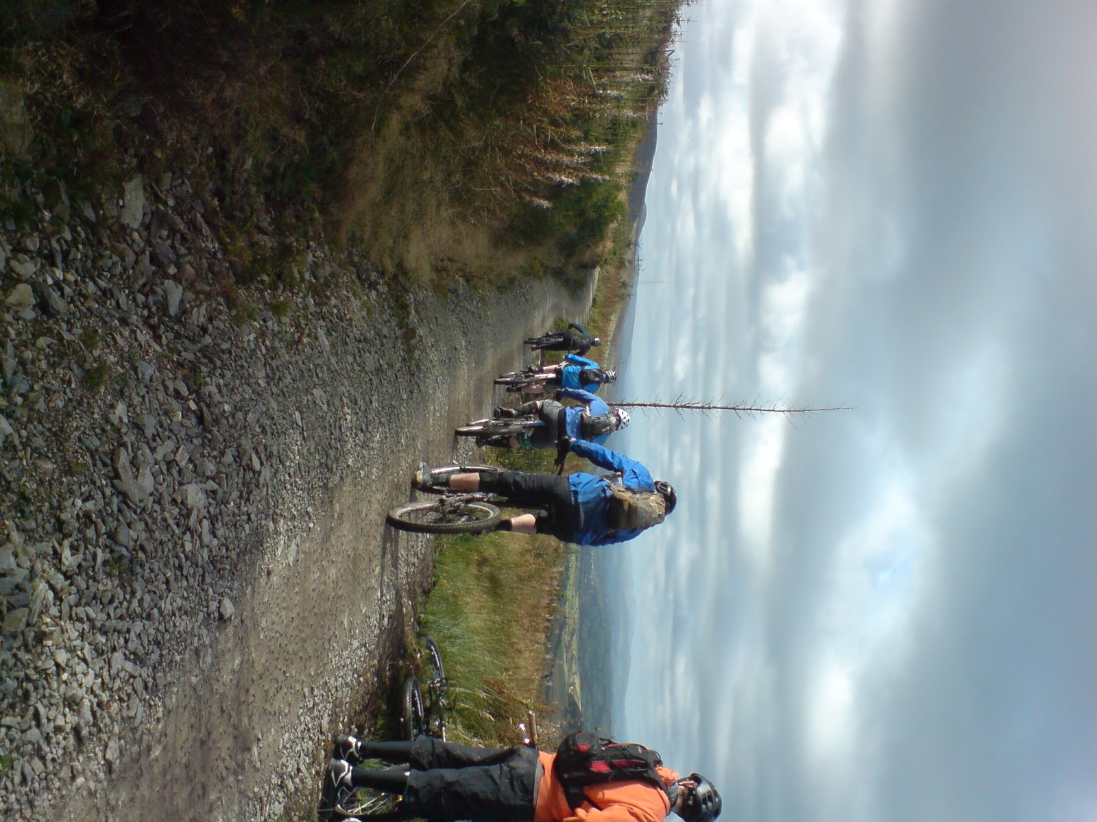
21 Jan 2013

Blockley - Cotswolds


Blockley – Cotswolds

Distance:               23km
Climb:                    1640ft
Duration:               1.5-3 hrs
Rating:                   Blue
Grade:                   3/5


It is peaceful plod through tranquil settings that never really deliver any real technical challenge or visual treat but somehow it still delivers on the good trail indicator.

This route is not, by any stretch, a technical challenge nor does it offer unending views of the Cotswold Hills. Blockley is a large picturesque village, set within a small valley high in the Cotswold uplands between Broadway and Chipping Campden; rolling hills thick with the infamous (famous with locals anyway) Cotswold mud and loose limestone.

Although there are generally not very many vistas of note the route is not spoilt as a result. The enclosed nature of the trail instils a feeling of remoteness simply because you cannot see anything but the immediate context. For much of the first half of the ride, this is predominantly trees.

You do emerge from the woodland for a few prolonged periods in order to legally navigate between certain sections of Bridleway. This scenic route takes in a number of villages, which add to the charm of the ride. On a bright summer's day its hard to imagine this being anything other than a beautiful place to ride.

The valley encircles Blockley and the route navigates its way around the top of this ‘bowl’, making one or two sharp deviations in toward the centre (Blockley village) to descend the hill - before making you climb back out again.

Starting in the beautiful village of Blockley – the route proper begins at Dovedail as you follow Blockley brook in to the woods. The Bridleway navigates along an historical route named 5-mile drive all the way to the A44.  Following a quick blast along the road, you’re back in the woods. Head straight through the belt and follow the bridleway back across to the return leg of 5-mile drive.

The climb out of Blockley is a stony track. It never gets too steep and traction was always good - the 2-kilometre climb up this tame gradient warms your legs up nicely.

This route is adapted from the guidebook ‘Mountain biking in the Cotswolds’ by Tom Fenton and has been repeated in MBUK magazine (GPS download available). Their published route follows the bridleways, however my route took a slight detour, at this point, in order to take in a couple of additional features and lengthen the ride slightly.

Following my initial climb I am treated to a fast and increasingly technical descent back in to Blockley (almost) before I head back up through Northwick estate (ensuring that I stick to the public rights of way as this is a managed woodland with active shooting on a regular basis).

The pass starts pretty tame but the gradient gets increasingly steep as it nears the summit before levelling off as you approach a minor road. I hadn’t appreciated how closely packed the contour lines were when I’d checked the OS maps before I’d set off. Anyway, what goes up must come down and after crossing the road the trail continues down the opposite side of the ridge.

The descent is shallower but longer. Technicality is low but you can get some serious speed once the ground dries. At the time of riding the trail conditions were still pretty soggy so mud spots had the unending habit of slowing me down. Alas, it was still good to get out and the respite from the climbing was welcome.
My current loop finally emerged from Northwick estate to the north and re-joined the 5-mile drive and followed the bridleway all the way to Broad Campden. The route then meanders around the foothills taking in Paxford before climbing back up through Batsford and descending down in to Blockley.

All the rain we have endured has again, as with most places I'm sure, turned the Bridleway in to a mud fest. The descent in to Blockley was disappointing, however Its worth noting that if one can find a sneaky way of reaching the lower gravelled section then it should be fun. One possible route is to navigate from the hilltop down through Pasture Farm using one of the farm tracks until the trail improves. In good weather this should be a fast and fun finale to the ride.


The actual highlight of the ride was, in fact, the post ride rinse. Courtesy of the bloated river passing through Blockley we were able to chuck our bikes in at a little access point (holding on of course) and repeatedly dumped them, like the stereotypical washer woman, to clean most of the mud off.  A great way to clear the mud and cow sh*t before loading the car.

18 Jan 2013

Christmas Common - Chinnor


Christmas Common – Chinnor, Chiltern Hills
Distance:                   18.1 miles
Climb:                        1935 ft
Duration:                    1.5-3 hrs
Rating:                       Blue/Red
Grade:                        3/5

Chinnor, near High Wycombe, sits on the edge of the Chilterns. This little hill packs a lot of riding in to a relatively small area. Mostly consisting of good natural singletrack, there are lines criss-crossing the hill in all directions - no two rides ever need be the same.

There is a circular bridleway around the foothills called the Ridgeway, which gives good access to a number of different climb points. Our route saw us head west from Chinnor to the locally named feature, ‘Widow Maker’.  The steep incline provides a fast and furious descent on many other route configurations but on our ride it was a steep and moderately technical climb.

There is a long and fast descent to follow (Kidney Breaker) down some single and double track.  The trail up to this point is generally chalky mud with loose flint and pine debris. It holds up reasonably well in the wet and sets quite hard in the dry. However, considering the excessively wet year we’ve had you’d best come prepared with skinny mud/winter tyres. When even the base layer is sloppy you know you’re in for a rough time.

A few kilometres of singletrack through low-level woodland precede another long and steep climb, this time up a farm track towards Turville Park Estate. The trail surface, at this point, changes to loose stone and flint gravel.

An opening in the wood at the top of the climb provides a welcome place for a quick break before you head back down through the feature locally known as ‘The Berm’; a fast and loose descent with a massive natural berm about 2/3 through the descent enabling riders to hold a huge amount of speed around the left hand corner. The trail surface and incline make this section the most technical part of the ride up until this point and, although over pretty quickly, is a highlight of the route.

The following climb is pretty standard bridleway stuff. The descent that follows this, however, is much more interesting. Starting off as a wide track through the immensely open forest floor of Great Wood, the trail quickly narrows and enters a natural half pipe. The sidewalls are high and in very close proximity to your pedals so commitment and concentration are required to navigate through the feature with pace and a smile.

The final climb is long and, on the particular day we rode, very wet and sticky. A quick stop was required to clean the tyres before embarking on the final descent in to Chinnor – ‘Route Finder’. It follows a familiar pattern to the previous descent in that it starts with a wide open fire track, this time along the edge of the wood, before taking a sharp right in to the wood using a huge rock slab berm. It allows you to carry good speed in to the following fly-off’s before a flat out race to the bottom.


Despite the appalling weather conditions the country has been dealt in the past few months this area of Britain has fared pretty well. There are patches of mud around, even some deep mud in places but nothing that would put you off riding the exact same route again.

Generally the bridleways and the Ridgeway have a good stone base, which limits the impact of the weather on these trails.

As we rode it, the trail around Christmas common in Chinnor offered a very satisfying ride. It has a good balance of singletrack and forest road (hardly any road riding at all).  The technical content is low but there are elements of interest. It is a good ride for most skill levels and an interesting place to ride in any case.

26 Nov 2012

November Diary


Mtb Diary - November 2012
12 Nov
It’s always slightly depressing when you finally realise that summer has passed. No more dusty, loamy trails – baked dry by the sun and rolling faster than you can recall.  Not that we actually got any of that this year (unless of course you went abroad – I’m envious of you).
Today, however, I have been lucky. As I sit at the top of Bredon Hill I can see for miles across the Vale and Cotswolds. With the sun shining so warm and the sky so blue, one could almost mistake it for summer.
But as I sit and take in the views I am under no illusions. Following a tortuous climb to reach the summit I can remark that it most certainly is not summer. The sun may be out right now but it has been raining all week and the muddy trails are a stark reminder of this time of year.  They have been turned in to wet sloppy imitations of their previous selves and the climbs, as a result, have become an ordeal.
Still, with views like this it's not hard to see the advantage for getting out. 

It’s been raining all week and may not stop for a long time. You’ll be waiting even longer for the trails themselves to dry up. Try sometime next summer, if we have one.
But do not despair. It is this characteristic that is so familiar to the British, to all those who actually get out during the darker months. There’s no point sitting around and moaning about it – another typically English characteristic. It is these types of trails that are responsible for producing some of the finest professional riders to emerge from the UK.
The likes of Steve Peat & Mark Beaumont have developed their skills on these slippery, rooty trails. Getting out on this will undoubtedly make you a better rider too. By getting out now and pushing your limits you’ll be quicker come summer and better to boot.

For those of you who really do find it hard to get the enthusiasm to get out once it gets cold, think of it this way. It’s only going to get worse. And, you will regret not getting out now once the dark days of deepest winter really set in – not that it’ll stop me. I find that some of the best riding all year only materializes once the ground freezes over. Why not get out now and make the most of the last embers of warmth from the sun? The extra miles you put in now (and over the winter) will pay dividends next spring.
18th Nov
Again, I have been lucky to get the sun. With the rain being persistent the climbs have become quite a challenge. I think it’s time for a tire change, my summer trail tires can no longer with the thick mud.
25th Nov
Over the last month I have repeated my ride over Bredon Hill on several occasions. At first my thoughts were centred on the idea that it is sad to see the dusty trails disappear. What I hadn’t bargained for was that they would be literally subsumed beneath the water as they did this week…

…So, it’s floodin’ out there! So bloody what! Why should that stop you? It’s not like it doesn’t happen almost every year anyway, so we should be prepared for it by now. Although I will concede, it’s usually in the summer. In places, my trails have literally disappeared – they are impassable. But, rather than sitting around and moping, I have found alternative routes to link up the remaining sections that are still rideable and, this weekend, I ventured back up Bredon Hill for some slippery fun.
I have been having some issues with brakes this year after trying to ‘restore’ a hope mini M4, however that has been resolved by the fact that I no longer need them. I simply stop pedalling and I come to a halt quicker than if I apply them at all.
Tires have been a huge frustration though. My usually adaptable all-rounders simply cannot cope with the knee-high gloop. I get the feeling that I’m navigating a boat rather than riding my bike. New ones are a must do, despite the ‘gulp’ price.
Still, there’s a certain gratification at having been out. A typical ride is no longer just a ride but a full-scale expedition and it feels good to actually get back in one piece. I’m not even bothered with pace. Timing is out the window. Everything pales in to insignificance, I’m out and that’s all that matters to me.
Trail centres have revolutionized the way we can approach our winter riding. The man-made trails are quite often designed to be ride-able all year round without being any less fun.  So why not take advantage of the additional access you have to trails. Kit up and get out and stop moaning!

5 Nov 2012

Verderers Trail, Forest Of Dean


Rating          4/5
Length         11km
Climbing      Not a lot
Time            40mins - 1.5hrs
Difficulty      Blue with Red options

The Verderer's Trail was penned by reputed designer Rowan Sorrel. It achieves an interesting brief by being simultaneously accessible for beginners and veterans alike. There are no hidden obstacles that will spark horror in the minds of novices. The distinction that allows both to enjoy this route is the speed at which you attack it.

Newbies can pootle around at their leisure without getting in to any difficulty and the more highly skilled riders tend to attack the trail at much faster speeds.

The Cannop Pedal'a'bike away centre has an array of mountain biking on offer. There are blue and red way marked xc trails, an collection of downhill tracks all accessible from the new uplift service (Fly-up Downhill). There's also a green family ride. The car park is quite often very busy but don't be put off as the trail itself is not usually very busy.

The trail itself is almost completely man-made surface with very few 'natural feeling' sections. Sitting within forestry commission managed woodland (there's evidence of this quite recently with a large area of tree felling about half way round - made the section feel a bit weird). However neither the character of trail nor the setting does anything to lessen the quality of the ride. It rolls pretty quickly and consistently even in severe wet weather and the trail is littered with loads of berms and dips/jumps to rail and pump.

The berms themselves are generally pretty good. Their construction, size and camber are all pretty much spot on for full attack. The trail gradually gains elevation through relatively slight climbs followed by flat pump sections. There are only 2 actual descents throughout the ride. The elevation gained is generally saved for the latter of the two, the final descent.  This is super fast and has great flow, in parts that is.

The final descent actually comprises of 3 smaller, manageable, sections. Each is split from the last by a small fireroad link. The first section is in the woods and it flows like a silk ribbon through the trees at a good speed. There are some off camber sections, but nothing to worry about. This part retains the close singletrack feel of the preceding climbs with the towering pines all still in attendance.

This character continues through section 2, although the trail gets slightly quicker and more technical. The introduction of some large berms towards the end prepares you for the moonscape that is the final section.

Emerging on to the fireroad you are presented with a wallride to set yourself up square for the start of the final descent. This section is made up of a heavily surfaced, rocky rollercoaster of huge rollers jumps (depends how fast you go) and berms that simply beg for you to go faster.

The route overall has an engaging character and as a result riders tend to attack it most of the way round. At 11km this is a perfect length for that kind of approach. My only gripe is the climb stuck in the middle of the final section of the final descent. In my opinion it has no place here, it ruins the flow of the, saps any energy you had left and almost spoils the flat out final final bit.

The link is needed to traverse some ground until you reach the amphitheater that is the very end and is probable exacerbated by the limited altitude available but come on! Sticking an up bit right in the middle of the down bit is bad form if you ask me. And, the rollers introduced right at the beginning of this climb prevent you from being able to power through with the momentum you've gained which makes it even worse.

I'm sure the relatively small altitude available to the designers hasn't helped but I'm sure there's a better solution to this section. Or, is this the bit that separates the men from the boys. Perhaps I should do some more training?


With the above in mind, I would (and have) still go round again! Although If I do I generally complete a loop of an off piste red trail (which links to the top of the final descent of Verderer's) to mix it up a bit.


2 Nov 2012

Coed Llandegla, Wrexham

Length:              21km
Difficulty            Red/Black
Climb                 Lots
Duration:           1.5 – 3hrs
Grade:               3/5

If this trail were rated merely for the black graded sections, it would get 5/5 in my book.

The approximately 8-10km of actual black graded trail offers a great mix of terrain, typology, speed and fun. There are jumps on every straight and berms at every corner. The only downside to this palate of delights is that you are unwittingly coaxed in to pushing as hard as you can without ever really planning to. Don’t get me wrong; this is how it needs to be done – Hard. Fast. Smooth!


It is, however, quite hard to find the same level of enthusiasm for the rest of the trail, especially after sampling the black bits.


The trail is essentially the red loop with the added spice of the more technically challenging ‘black’ sections. Combined, this offers 21km of trail. Not all, however, is singletrack. The ride shares the initial climb from the car park with the blue trail. As such this makes for an initially comfortable and start, allowing one to warm up gently and facilitating chat amongst riding buddies. The lack of a technical challenge very soon becomes tiresome, unfortunately the climb continues for what begins to feel like a never-ending length of time.

The fact that this area has been clear felled only adds to the tiresome nature of this first section. One advantage, I think that were the start as engaging as the black sections the trail would inevitably be very tiring, however this is a very minor benefit for a complete lack of interest.

As it is, I could only just manufacture the will to pedal up the final climb, only to be disappointed yet again. There is, to my despair, no final descent to the car park, which makes for quite an anti-climax to the end of the ride. A final descent usually provides a definite and perfect end.

There is definitely a feeling that the Red sections (i.e. more than half of the actual trail) were merely a link between the trailhead (visitors centre & car park) and the black sections.

As bad as this may sound, these sections are actually worth the pain. With great north-shore trail followed by one after another of really well crafted table top jumps and drops and super big berms you cannot help it to find a massive grin spread across your face after each and every section. They are quick, they flow superbly well together and there are no dodgy switch back corners in silly locations to spoil your momentum (warp speed btw).

While riding through the initial blue section, a friend of mine commented on the regimented nature of the trees – set out to aid felling for timber supplies. This is a clear indication that the woodland is by no means a ‘natural’ landscape. The trail itself is a reflection of this. Like an A-road passing through the English countryside, the trail carves a similarly drastic line through the wood with very little connection to its surroundings.

The designers appear to have favoured substance over style. The trail is hard packed stone and appears well managed. There was very little evidence of erosion or damage from use. There are a number of well placed drainage culverts, mainly on the steeper climbs/descents to ensure that rainwater cannot damage the trail and where ever the trail traverses boggy ground you are treated to sections of boardwalk to stave the mud-fest. The loop has definitely been designed to last.

The trail, as a complete entity, felt much longer than it actually was. In fact there was a certain level of disappointment between my riding colleagues when they were reminded it is only 21km. The level of engagement and effort used on the black sections (i.e. having fun) distorted the normal flow of time somewhat – time flies… as they say!

1 Oct 2012

Cleeve Hill

Difficulty   Easy-Hard
Climb       1000ft and more
Rating      5/5
Time         2hrs - All day

Cleeve Hill near Cheltenham lies on the Oolitic limestone escarpment at the edge of the Cotswold hills. As a result the local riding is dramatic to say the least and with more than a 1000ft elevation gain in less than half a mile the climbs are definitely hard going.

There are, however, superior rewards for those willing to put in the effort required to reach the summit of Cleeve Hill. Alpine-esque trails snake across this grassy highland like yellow ribbons offering multiple lines; plenty of thrills and testing skills. With views to die for, its really quite hard to ever fault a place like this, especially when the sun is shining, warm on your back.

Rather than parking at Cleeve Hill, I have found that Winchcombe is as good a starting point as any. It allows for a number of different xc routes, which incorporate Cleeve Hill and ensures that, after hours spent playing at the top, there is a long and fast descent to finish the ride. Plus, with plenty of tea rooms, there is always the opportunity for some good post ride cake.

One of my favourite trails climbs out of Winchcombe via Gretton Hill (in the opposite direction to Cleeve Hill) and, following a diamond descent in to Prescott, climbs up Nottingham Hill (killer) and across the top to reach Cleeve Common.

After that you will definately need a rest, and with fantastic views out over Cheltenham (racecourse) and the river Severn (with black mountains in the background - on a good day) its hard not to spend too long having a 'little' rest.

Cleeve Hill plays host to an 18-hole golf course so passage along the main bridleways must be done with consideration. Heading towards the '3-masts' the trails then circle back across Cleeve Cloud.  Follow the line past the golf club house and towards the east of Cleeve Common (washpool). There are a number of good lines to explore in and around the old quarries.

Mountain biking is strictly restricted to the bridleways, however, if you are willing to risk it, some of the off piste trails are quite fantastic. Being part of the Cotswold escarpment the trails benefit from being usable all year round.  The base limestone rock is generally littered with smaller fragments making the surface quite loose, but cutting through the gravel the limestone offers good grip; it rolls well and, due to the porous substrate, water tends to drain away quite quickly.

Linking the quarries near to the wash pool in with your ride is highly recommended.

Despite the positive outlook, in wetter climes the hill can be a bit tortuous. Being so exposed the north west side (Cleeve Cloud - towards the three masts) can be extremely depressing. If your heading up then stick to the relative shelter of the eastern (Winchcombe) side.

After a days session, try heading down via bridleways to either Postlip (heading to Winchcombe), Nottingham Hill or Prestbury (via the three masts). Good uninterrupted descents!

Cleeve Hill has everything you would expect on a trail centre ride without being man-made. Neither does it have the traffic common to so many centres. The views are as good as any I've seen. Who needs trail centre's? Well, Cleeve Hill may be epically awesome, but variety is good!


18 Sept 2012

Monkey Trail, Cannock Chase

Distance:     29.95km
Climb:         806m (not all in one go)
Time:          1.5-3 hours
Difficulty:     Red / Black options
Rating:        3/5


"Fast rolling, predominantly singletrack trails with plenty of technical interest on the ups and downs"

Cannock Chase in Staffordshire is a very well placed venue to pick up a large volume of people.  As such the trails can get rather busy and there are other activities on site so the car park can, at times, resemble sardines in a tin. Don't be put off, however as trail congestion is not a big problem here. To ensure you have the trails predominantly to yourself, however, I would recommend a weekday visit.

Aside from the trail itself there are a good mix of facilities here. There's a bike shop, a cafe selling hot and cold foods a picnic area and a decent toilet block. An external water supply for filling those bladders and I believe a bike wash, although I've never used it. There is a decent sized car park plus a whole load of other ways to explore the forest (such as Go-Ape!). But the trails, they're pretty good too. There is also a downhill venue a mile down the road. The runs are short but fun.

The main trail at Cannock The 'Monkey Trail' is an extension to the already popular 'Follow The Dog' route, both of which are classified Red. 'Monkey' splits off seamlessly, missing only a very minor section of 'The Dog' before rejoining less then 500 yards up the trail.  Together the two trails offer a good mix of character from fast singletrack and technical riding to more open (fire road) sections. This also provides a balance to the pace too, allowing riders to place more effort where it counts. There are also a number of Black graded optional extensions along the route, which offer welcome technical aspects.

The trail flows reasonably well and it certainly makes the most of the limited elevation through its numerous climbs/descents. The cobbled trail surface is set in hard packed but sandy earth. It does offer reasonable amounts of grip in the dry and it tends to run fast in the wet. However, I have noticed over the last few years how quickly it appears to break up. There are a number of places where the surface has broken away under braking, causing quite severe breaking bumps, especially in to the large berms on the downhill sections.

There does appear to be quite a good maintenance programme and there seems to be a constant effort to improve the trails, with new bits being added almost constantly. Although I admire their effort in this respect, I do wonder whether more resources would be better placed at keeping the existing trail in better shape or developing the construction in these high wear zones. Unfortunately, I think the real problem is beyond mere maintenance.

There is one underlying issue that niggles me as it spoils what would otherwise be a fantastic trail.  The switch backs!  They work well as a climbing tool by reducing the gradient and they are used extensively at Cannock. I would vehemently argue, however, that their use on the downhill sections is somewhat questionable.

The trail utilises switch backs to offer longer descents.  This in itself isn't so bad but the size and construction of them is more concerning. In their current state they offer little support, they are far too acute and unfortunately suffer heavy erosion making them incredibly loose. This spoils the flow of an otherwise very good trail and given the predominant bike used here I would suggest they need to be much more robust to maintain flow and retain speed.

Cannock is actually one of my favourite trail centres. I've ridden the trails a number of times, and as a result I've become more aware of which bits do and don't flow. It's not going to stop me coming, In fact I may well be there again this weekend.