11 Nov 2013

Snowshill - Cotswolds

Distance 26km
Climb c350-400
Time 2/3 hours
Grade red
Rating 3/5


This trail contains an assortment box of classic Cotswold features in to one peaceful and beautiful ride. From the sticky clay that is famous of these parts to the natural, loose-gravel singletrack found on the higher grounds, where the earth has been worn thin through years of erosion. From rolling grassy hills extending high over the wolds to damp and rooty woods.

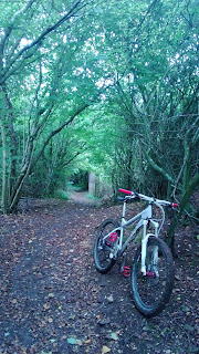
Starting in Broadway and following a quick blast along the B4632 towards Winchcombe, there is a long climb up to Snowshill. Pass through a farm, bearing left, and, following a sedate cruise along the lane, head in to the village. 
Pass straight past the pub (it's probably too early in the ride for beer so keep going) and head up and out of the village. After another short road blast (minor) the trail heads off road and climbs along a typical stony track before passing through a copse and around the edge of two fields.

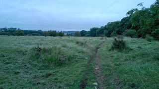
Arriving at the third, one finds an array of natural sheep tracks criss-crossing the field, which offer short but sweet roller coaster style fun.


The next section of trail, following another short road jaunt, follows a wooded singletrack bridleway for an extended period before opening out in to a wide valley. The  trail continues along a thin ribbon of dirt trail that follows the contours of the hillsides until you reach a farm. A steep climb through the woods brings you back out on high wold country. 

At times one can feel distinctly isolated. Despite being on top of the Cotswolds, the escarpment is a few miles away. As such you are denied the wide expansive views of Leckhampton and Cleeve hills to the point where you can feel a little like you're in the middle of nowhere at times.

In the summer, however, I would suggest there's no better place for 'loosing yourself'. The peacefulness is sublime. Just you, the bike and Mint Sauce for company. 
The trail passes through a number of fields, gates and styles unfortunately breaking up the flow slightly, as you head back towards Broadway.

Latch on to the Cotswold Way at Littleworth Wood, revel in the speed and increasingly technical terrain on this descent before dropping back in to Buckland and on to Broadway.  Alternatively take the cheaky shortcut through a few fields, following the Cotswold way all the way back to Broadway.

There are sections of this trail that fall foul of precipitation quite badly effectively limiting this one to a gloriously sunny and frosty winters day, when the ground is frozen solid, or once the ground has dried during the summer. However, despite this, the descent in to Broadway is still worth the climb so can be combined with an alternative XC loop or completed as a quick fix

If you are not a resident of the Wychavon district, parking is available in many public car parks, including Milestone Ground (long stay) and Broadway has plenty of cafés and pubs for post ride drinks and cake.

9 Nov 2013

The Gap - Brecon Beacons

Distance:   22.5m
Climb:       c725m
Grade:      Red/Black
Time:        2-3 hours
Rating:     4/5
This trail, as featured in MBUK magazine, has, quite simply, one of the most technically engaging and thrilling descents I have yet had the pleasure of riding.

Following a decent climb from Talybont-on-usk - one that never gets overly steep or technical - albeit a long climb of approximately 350m rounding the Talybont reservoir to the top of the hill. There is, to follow, a section of singletrack across open and exposed hilltop Moreland.

This gradient gradually changes from flat to descent, quickly becoming an extremely fast opening section, and leads to a gateway approximately 1/6 of the way down the hillside.

The top of the hill and opening section of the descent is a slight departure from the general terrain characteristics of The Gap, offering slightly smoother lines from the top of the climb to the gate.  From this point, however, the trail gets all kinds of rough.

Rocks the size of TV's litter the trail and, with very little definition of a 'racing line', there's very little option but to adopt a loose riding style and attack the rocks head on. Dropping approximately 200m over 1.5-2km was a real pleasure. With no other gates or styles to cross from the gateway mentioned earlier to the waters edge of the Pentwynn reservoir we were free to attack at full-on flat out pace from top to bottom.


Early sections of the trail - the climb and traverse - offer a hard packed but rocky terrain, although nothing more technical than what one would expect at a red graded trail centre. However both descents offer a significantly higher technical challenge and would definitely rate as a black section.


The rocky nature of the trail, in general, makes it hard going to retain speed and rhythm on the climbs without the assistance of some rear travel. I completed the loop on a 150mm travel bike and was grateful of the absorptive effects considering the nature of the black runs. I guess it would be possible to complete the loop on a handrail, but why would you want to? Give your package a break and take some bounce.


After another long climb up to the natural feature from which this trail earns its name, The Gap, there follows a steep and technical descent, followed by a cheeky low gradient climb before another flat-out blast to the bottom of the mountain.  Before embarking on the final descent, however, take a bit of time to absorb the fantastic views to be had from this point of the trail (for they will be gone all too soon).


The Gap is popular as a walkers trail as well as with mountain bikers. On the climbs and less demanding sections this is not such a problem. However, the descents are worth completing on a clear run - the first is not an issue as it's a deviation from The Gap. However, the second has the potential to become busy. As such it is worth tackling The Gap on either a week day or early morning to make the best of the final descent.

Back at the bottom of the mountain a quick blast on the lanes precedes a brief excursion along the tow path of the canal back to Talybont. This offers a pleasant way to cool down the muscles before the drive home.

There are no facilities in the way of trail centre luxuries. Parking is available within the village of Talybont and toilets and food/drink are available at the nearby pubs.

1 Aug 2013

Raven Trail, Brechfa

Distance:   18.5km
Climb:       725m
Grade:       Black
Time:        2-3 hours
Rating:      4.5/5

Tough opening climb separates those who are fit from those who aren't but the rewards for your investment are some seriously thrilling downhill sections.

Unfortunately this isn't a full review. I will have to return to Brechfa at some point to finish the Raven Trail as my riding partners and I only completed the first half, missing a second climb and the final descent to link up with the Gorlech trail and complete a mammoth 26.5mile journey with 4500 ft of ascent.

However for the purposes of this review I shall refer to the sections of the Raven trail only and will update at a later date with a fuller account.

The trail starts from a very basic car park with little in the way of facilities. In all fairness there are plenty of places one can grab a drink, nip to the loo etc within the village of Brechfa, which is only a stones throw away. Plus, I'm not sure that a massive trail centre would be right image for this area. It has a very subtle and tranquil quality. Less is more.  It's like its a little secret, tucked away out of sight.

Being so far west, the place is never very busy. In fact you'd be going pretty fast, or slow, to meet any one whilst actually on the trail.  This is not, however, a sign of a bad trail. This is, by far, one of the most interesting and fun trails I have ridden.  In fact the Raven here, Gorlech and the smaller Cwm Rheaedr up the road make for one hell of a weekend.

Passing through the large Raven's Wings starting gate, the trail itself begins with the, ever present, fire road climb. Thankfully this does quite quickly give way to pleasant singletrack. The surface chopping and changing between compact stone gravel, to loose and wet earth.  With very little let off, except for two switch backs, the trail continues to steepen for what feels like an eternity. Just when you think you've crested the hill it continues - out of sight.

Anyway, you do, of course, reach the top eventually. What follows is a long descent. Broken up in three sections, each very different. The first a rhythm section of tight turns and sweeping singletrack with a loamy/ rooty surface cut up with loose rock and damp earth. It emerges on to a fireroad with the next section beginning directly opposite.

The next section is fast and has a very natural feel to it. It sweeps through the oak woodland on dense earth trail and begs for you to ride faster. And, why not, as there are no major surprises along this short part. It traverses the hillside, following the contours and loosing very little altitude for the speed your going.
 
However, do keep your eyes peeled as the following section is remarkably different. The trail turns down hill and gets very steep indeed. Utilising massive berms cut in to the very bedrock of the hillside to keep you rubber side down. These berms are not your average smooth offerings either. These are rough as old boots, the various formations - visible where they have been cut through - create a rumble strip affect as you pass over them with very little option but to commit.
 
These eventually tame to 'normal' sized berms a bit lower down but retains its warp speed setting before spitting you out in to a clearing at the very base of the valley.

The blue trail, which has essentially followed us round, on a parallel track thus far, re-joins for the following fire road climb. A light incline along an oak lined track offers plenty of time to catch your breath and regain your composure before embarking on the next section of singletrack.

This was equally as fun as the first downhill but for different reasons. The nature of the trail here became very natural, tight and twisting. Reminiscent of trails back home where the line weaves its way through the ancient woodland, tracking around and over any obstacles, in a bid to leave as little trace as possible of our existence. Obstacles become less consistent with the drops, dips and rollers of a typical trail centre and more variable like a true off piste trail.  It's rooty. It's up and down-y, its twisty and great fun.

As you complete the section you, again, come out on to a fire road, which happens to be the very top of the final climb of the Gorlech trail. It is here that we made our escape and joined the red trail - please see my other review for a low down of this trail - and complete a loop of this also. This meant getting to do the red descent twice (can't complain as its great).


26 Jul 2013

Red Trail - Cwm Rheaedr

Length:     6.7km
Duration:  45mins
Climb:       210m
Grade:      Red
Rating:      5/5

Cwm Rheaedr or 'valley of the waterfall' is a little gem of a trail nestled deep in the hillside overlooking the Tywl valley. It is a short but, ultimately, fantastic trail and well worth combining in to a longer visit to the centre of Wales.

The trail at Cwm Rheaedr begins from a fairly typical Forestry Commission car park just outside the village of Cil-Y-Cwm. There are no facilities. However, that merely adds to how great the place is. Rather than your busy, sanitised trail centre like Cannock (which does have its merits) this is serenely quite with very light trail traffic. On our 2 loops I did not see one single other rider (apart from my riding partner that is) - although it was a Friday afternoon and welsh trail centres tend to be significantly quieter than say Cannock or Ashton Court.
With designer, Rowan Sorrel's name preceding him, expectations were high and we weren't disappointed.  The trail starts with an all too typical fire road climb straight out of the car park. This is not much of an issue, however.  In this case the fire road climb is long but lacks gradient so can be dispatched reasonably quickly and without need of much grimacing or curses.

Chatting is a sure fire way to make the dull bits pass quickly and, despite the fantastic views and relative ease of the climb, it is still just a fire road. So, chatting all the way up, we were somewhat surprised to find ourselves at the top so quickly. It's a fair amount of altitude gained in a short time with somewhat less effort than I am normally used to - maybe I'm just getting fitter!

Anyway, the fire road gives way to graded singletrack, which climbs for a short while longer. And, after a short break on the bench provided at this threshold to admire the view of the waterfall we were on our way.  There are a few switch backs to navigate and a small across section before you climb steeply to reach the summit.

There is no ceremonial indication to suggest that you are now pointing down but be assured, you will not want your seat up from now until the end of the trail.

What follows is possibly one of the most flowing of sections of singletrack descent I have ridden and deserves maximum attack. Its hard to really put in to words how much fun I had coming down. The surface itself changes from the man-made compacted, stone gravel of the fire road and opening singletrack sequence to a much more natural, earth based surface incorporating odd outcrops of the underlying strata - which is exposed on its edge providing a rumble strip effect - to create a bit of added interest.

In the dry and damp there is plenty of grip available. Even the loose shingle that litters the corners of the upper section give way to a base of hard earth and stone eager to provide the daring with ample purchase.

The top section is reasonably quick but quite rocky in places with a number of drops to send it off. As you head in to the woods things get a little more loamy due to falling detritus but not by much.  The tacky sub-base and loose scree follows you most of the way down - the scree becoming more absent the further down you travel - where it gives way to the plain tacky earth base.

The middle of the descent becomes quite tight with the trail becoming no more than a few inches wide in places where people have exploited the 'racing line' and crosses two rutted access tracks at two points. This was a little like changing tracks at a railway junction - especially as it was off camber - and took commitment and speed to ensure I stayed on line.

As you come in to the bottom section things get a little faster still with wide cambered corners (not quite berms) catching you at every turn and allowing you to maintain a significant speed all the way to the car park. Somewhere in this section (before the final crossing point) you'll come across a reasonable wall ride.

My riding partner and I were at full speed pretty much the whole way down and with no gates or styles to cross it was literally all the way from top to bottom.


17 Jun 2013

Leckhampton & Birdlip


The Lecky and Birdlip route could be described as a very typical ride through the Cotswolds. It comes from the Cotswold mtb guide book by Tom Fenton but with a few minor alterations to make it a bit more fun.

Navigating around the southwestern escarpment of the Cotswolds (Gloucestershire), it benefits from beautiful views over the Severn estuary and to Wales, superbly technical climbing/descending and to top it off a leisurely gallop through the rolling hills of the 'wolds.

The route takes in some very pretty villages including Birdlip and traverses some stunning scenery that, over it's 34km length, cannot be beaten on a warm and pleasant summer's day. With fields a plenty of wildflower, pine and beach woodland rushing gently in the wind and the farm life grazing as a backdrop, one can simply pass through as though in a day dream (or a scene from a Mint Sauce strip). This is, quite simply, what summer's days are made for.

Let's start by just clarifying, this is an xc route at heart. Yes, it has some very good, and quite technical, climbs and descents but nothing that would find itself on a DH course.

Starting from the Daisy Bank car park on Leckhampton Hill one should climb the escarpment to join the Cotswold way on the top of the hill. Take a brief moment to enjoy the view but don't linger for too long - you'll see it again soon enough.

Following the Byway through Ullenwood towards Birdlip you will take in a wide open descent followed by a steep climb up a typical loose Cotswold stone track. Here there is an opportunity to follow a bit of off piste woodland trail off to the right of the main track. At the top of the climb, head left and pass a farm before descending again in to open meadows.

Following the bridleway through the valley turn right and head through the wildflower meadows. Pass the kennels and underpass for the A417 road before reaching the escarpment once again. Follow the Cotswold way in to the woods and as far as the main road - climb on the road in to Birdlip turning right at the top of the hill before re-joining the Cotswold way to descend through the woods.

After approximately 1km bear left and head back uphill, emerging on to the road. Turning back on oneself (left) follow the roadside singletrack trail back towards Birdlip. Note: along this section there are two fairly technical drop-offs to be had so keep your eyes peeled.


Before actually reaching Birdlip head right through a belt of trees and, following the bridleway, head across country, away from the escarpment and in to the rolling hills.  Following a few kilometers on road, linked with small sections of Bridleway, you will reach Brimpsfield. From here there is a 1-2km light gradient descent in to the valley. You will reach a large lake, then a climb back out towards A417.

Navigate your way through a couple more villages before reaching a long 2km track slowly ascending back towards Leckhampton. This will eventually lead to the double roundabout, from which you head northwest re-joining the Cotswold way to round the very upper edge of the escarpment back to Daisy bank.  The sinuous, flowing singletrack weaving its way around the top of the hill - with a couple of hundred feet of altitude on your near left - is quite exhilarating.

Choices, choices. With only the final descent back to the car to attend to, there are choices to make. From the common atop Leckhampton hill make your way to the Bridleway. This descends at quite a fast rate but as it plateaus by the old lime kilns there are a number of downhill runs on offer which aren't overly obvious and have differing levels of extremeness. If in doubt ask someone for the most suitable line - as there is fun to be had on each. Its a befitting end to a super trail.

You can, of course, push back up and have another go too.

Pearce XC - Hopton Castle


Climb -
Length - 11-17km
Time - 1.5 - 2 hrs
Difficulty -  Red
Rating - 4/5

The Pearce XC trail at Hopton castle is not a considerably long route but what it lacks in distance in certainly makes up for with sheer variety and content.

The full route is split in to 3 sections; the taster loop (2km), the main red trail (11km) and the blue extension loop (4km). Together they make for a very engaging ride with plenty of technical content and varying trail conditions to keep the rider focused.

The trail also declares an assault on the senses with its stunning scenery and fragrances to intoxicate.

I've ridden here twice, and on both occasions I was done by the finish line. For a short route it certainly uses a fair amount calories so bring food as you'll want some energy for the final climb.

In places the trail has a similar feel to it as Cwm Carn with its loose rocky terrain. However, the start  is more loamy than rocky. Unlike any other trail centre I've visited, Hopton starts with a pretty good descent, navigating down the steep hillside and deep in to a valley. The steep lines, well bedded berms and roots all over the place make for a full on opening section.

Following a slight climb the terrain changes as the route passes through an old stone delve (this was, in fact, the delve used for much of the new stone used on the repairs to the actual castle at Hopton Castle in 2011), the trail becoming very rocky and loose. A quick singletrack section full of berms and sweeping corners brings you out on the beginning of the climb.

This is a killer of an ascent but thankfully it is split in to more manageable sections. Initially a bit of fire road links to some switchbacks. These lead back to fire road where the gradient steepens. The climb levels momentarily before the final flourish. You emerge in a wide clearing with views over Herefordshire/Shropshire (this is a good snack point).

The following sections get pretty technical as it enters the woodland. The trail is absolutely littered with roots. You cannot avoid them so speed, flow and line choice is quite critical to ensure that you skim over them rather than getting bogged down. As you emerge from the trees the xc route joins the DH track for approximately 100 yards. The line simply invites you to go faster with good visibility down the trail but, again, it is a very rooty section. Also, make sure to keep your eyes open for the way marker as the two routes split very suddenly.

Following a short fire road blast the route nips back in to the trees for some more big bermed descending followed by quick singletrack through open grassland. In general visibility is again pretty good with exception of mid summer when the grasses are their highest. Grip is good though so you can go at a pretty good canter.

Following a brief climb repeat the last paragraph before embarking on the grueling climb back towards the car park. This is probably the one gripe I have but its more of a reflection of my current fitness than anything. Not only is the end of the trail a climb but its a harsh ascent at that. It just keeps going.

The final roller/pump section flows pretty well, if you're alert enough to pick the right line and speed. Tired and this section might feel a bit clumsy. 

Hopton Castle has a long standing history in mtb and the PearceXC trail adds to this pedigree. The route has none of the manicured feel of other man made trail centres. In fact there is no real centre at all, just a forestry commission car park and a sign board. I think this adds to the rawness, and attraction, of the place.  It has much less traffic than an average trail centre to the point that I was the ONLY person on the trail when I rode it and it was pure bliss.

Lets hope that potential routes nearby are as successful, keep an ear to the grape vine.


6 Jun 2013

ElNinoMtb - mountain biking related artwork

Mountain Biking related artwork
 

The above link is a url for my Etsy shop, from which I am selling various mountain bike related artwork. I currently have 2 pieces of artwork available and they are described below.

As a trainee Architect and artist I believe I have developed a keen eye for design. With a massive interest in Mountain Biking it feels only natural for me to direct some of my creativity towards the sport I love.

Below is a description of the first two items I have produced...

Product 1 - 'trail centre info board' with inspirational Einstein quotation.

This was initially designed as a moving in present for a friend of mine. He, like me, is an avid mountain biker. I wanted to give him something that would really hit the spot. He really liked the piece, as did many of the guests who encouraged me to produce more and sell them - so I have.

The plaque is designed to look a like a trail centre information board and leads with an inspirational quote by Albert Einstein "life is like riding a bicycle, to keep your balance you must keep moving". The piece then expands to metaphorically describe life as a mountain bike trail.

The design has been professionally printed on to vinyl and backed on to a metal plaque. The plaque is mounted on to a timber board to give it an authentic trail centre info board feel.

I have used the correct type font for the text and the image of the bike is adapted from that generally used for trail marker posts as seen at numerous trail centers around the country.

The metal plaque is set off of the back board with spacers and fixed using socket head bolts to maintain authenticity in the mountain biking world.

Item measures 43 x 22cm. Limited run of 50 produced - each is individually numbered


Product 2 - UK trail centre map - in a London Underground style

This poster is designed in the style of a tube map and depicts, and links together, most of the popular mountain bike trail centers of the UK.

It uses a keyed set of colours (Green, Blue, Red, Black & Orange) that reference the typical grading system to link together appropriate centers depending on the classification of trails at the various venues.

The venues included are
England: The Track Portreath, Gawton, Haldon, Ashton Court - Leigh Woods, QECP, Swinley, PORC, Aston Hill, Woburn Sands, Forest Of Dean, Hopton Castle, Long Mynd, Cannock, Leamington, Chicksands, Thetford, Sherwood Pines, Warncliffe woods, Stainburn, Delamere, Lee Quarry, Gisburn Forest, Dalby, Grizedale, Hamsterely, Winlatter.

Scotland: Kirroghtree, Dalbeattie, Mabie, Ae Forest, Kielder, Drumlanrig, Newcastleton, Innerleithen, Glentress, Carron Valley, Arran, Fire Tower Trail, Fort William, Laggan Wolftrax, Moray, Learnie Red Rock, Golspie, Balblair.

Wales: Cwm Carn, Gethin Woods, Afan, Brechfa, Cwm Raeadr, Coed Trallwm, Nant Yr Arian, Machynlleth, Coed Y Brenin, Antur Stiniog, Penmachno, Betws Y Coed, Llandegla

Poster measures 38 x 28.2cm and would suit a frame of 40 x 30cm as shown in the photograph and is printed on approx 160gsm paper to give a bit of weight.

This is an intriguing design that entices people to stop and look and has a familiar easy to understand feel to it.

This listing is for unframed poster only


Please go and check out my listings or like them using facebook or twitter.

17 May 2013

Afan Bike Park

Distance: n/a
Climb: n/a
Grade: 1/3 & 2/3 (Red/Black)
Rating: 4/5

Afan Forest is widely known as one of the Gem's of welsh mountain biking and with the new Bike Park, designed and implemented by Cognation, it has s a very good addition to what the area already has to offer.

The new bike park is located at the top of Y Wal near to the Brynn Betws Lodge and sits adjacent to the new singletrack extension to the trail itself. There are several short routes of varying degrees of difficulty comprising big berms, jumps, drops and swooping trail, plus a couple of skinny log sections and a rocky loop that'll test your balance and poise.

Following the grueling climb from the Afan centre on the Y Wal trail the Bike Park will offer a welcome distraction and place to give those weary legs a little breather before embarking on the final descent. For those who don't fancy the trail first, it can also be accessed by car, with parking available literally 50ft from the entrance. Use the Post Code SA12 9SP.


Of the 7 routes available 4 are graded 1/3 and three are graded 2/3. The higher graded lines are the skinny log line, a series of large doubles and the big line. The jumps along this section, in particular, get pretty large.

Despite the scale of quite a lot of the jumps and berms here, they are all pretty much rideable for those wishing to keep both wheels on the ground.  Naturally, however, the faster you go the more fun it is and at speed each trail starts to make a lot more sense. The jumps become technically more challenging as you have to commit to a bigger or longer jump, making line choice more critical but more interesting.  The berms do a great job for speed retention making the jumps significantly easier.

I wasn't initially comfortable with the type of surfacing used. However, after a few runs, a more drift happy approach to riding was adopted which saw me picking up more speed with each attempt, committing a lot of speed to the berms off the back of each series of jumps. There is grip in there, if you're willing to look for it.

Although each individual line is relatively short, it does mean that a day's fun can be had without the need for an uplift truck. The venue is easily push-up-able for repeated attempts - just don't get complacent - and once you've had enough of the park there's the final descent of Y Wal to look forward to. What's not to like.

I was quite impressed with the Afan Bike Park and will most certainly be stopping off each time I visit Y Wal from now on. I do think it is a bit small on it's own but when combined with the trail itself I think it makes more sense and invigorates one of the original trails.

16 Apr 2013

Twrch Trail, Cwmcarn


So, what has happened to cwmcarn?

Well, some of you may have read some threads over the last month suggesting that the Twrch had been irreparably amended during maintenance work to the extent that the natural, rough and rocky character had been ruined. This is, categorically, a load of rubbish...

Indeed, maintenance works have been conducted at various points on the trail. One section (between A and B) remains closed while Cognation, the trail design extraordinaire,  provide some much needed tlc. That is, essentially all it is. A bit of tlc to some of the more worn sections of the trail. Namely between Airstream and Odin.
Generally, the trail remains its fast and technical self. A challenge to those who ride it.
So, what is Twrch actually like.  In basic terms it forms an up, an across and a down, although there is a small down/up in the middle. The main climb is a mental exercise as much as it is a physical one. It is a long and enduring passage along technical singletrack (challenging in places) mixed with other fire road and double track sections. The inclines are constantly changing as is the trail surface. From root infested hard, packed earth, to loose gravel and flint to typical fire road. There are also large rock slabs placed conveniently about the trail for us to dodge/use.

At the top of the climb one is rewarded for all that effort with a quick freeride area incorporating a black and a red loop. Both lines can be repeated by riding back up the adjacent fire road. Both lines are fun with large berms and jumps/doubles. The surface here is typical trail centre fodder- made up of hard-packed base with loose gravel over. Where this has bedded in the trail gives good grip, however in other areas it still feels a little loose. But, then, it all adds to fun time hanging the back end out. The berms will catch you so get on with it. It is pretty much rideable in most conditions but does get pretty sloppy near the bottom in very wet conditions.

Some people find the final downhill a bit tedious but in my opinion, they're just not going fast enough. The final downhill is rough, tough and needs attacking to get the most out of. Simply cruising down, you are apt to be bounced about like a loose apple in an apple cart, and probably just as bruised.

Trust your bike and hit this thing hard, you'll thank me after. It's an edge of your seats hanging on roller coaster of a finish. It flows superbly and the ground has loads of grip. The only way I can aptly describe it is to say it is like being sonic the hedgehog in one of the special stages . There are berms and edges to support through every corner and the section gets gradually faster to the point that the moisture streaming from your eyes starts going backwards instead of down.
Cwmcarn is, to me, as good as it's always been. Long may it remain.
 
It is worth noting, also, that Cwmcarn has a newly constructed car park, which is a much more user friendly layout than it's predecessor and as part of the ongoing improvements a new toilet block and workshop is being built at the entrance of the car park.

21 Jan 2013

Brockhampton & Whittington

Winchcombe mtb – take 2

 
Distance:            31km
Climb:                 1500ft
Duration:            3 hrs
Rating:               Red
Grade:                4/5


This route is a classic. In general, it passes through Sudeley, Brockhampton, Whittington and Cleeve Hill in an approximately 31km long loop through atypical Cotswold scenery. There are 3 ‘climbs’ and 3 ‘descents’ and plenty of winding singletrack in between. Skirting the escarpment of the Oolitic bed that is the Cotswolds, there are superb views on offer, in almost every location and direction. There are also some deep ravines, offering that feeling of seclusion, of absolute and complete remoteness.


The trails are well defined but not heavily used and so fair well during all seasons. However, there are places, as with any natural trail, that can suffer under prolonged spells and struggle to recover there after.


Generally, as with most XC trails, the single-track is linked together by a selection of road sections. These come in the form of quiet lanes or track (no main roads) so aren’t that bad and represent a very small percentage of the route too. The longest section being the climb out of Winchcombe.


There are other ways to tackle the climb, of which a number are of road. But the hill is so steep and long that it makes sense to conserve energy by utilizing the road.


The trail shares the first section with Winchcombe mtb (take 1), however, upon emerging from Sudeley wood, instead of heading in to Farmcote Estate, riders should take a right and follow the Bridleway across the open ground towards Hawling. Pass through the church and nip across the farmland to the style at the roadside. Here, cross the road and follow the twisting single-track as it shadows the dry stone wall. This leads all the way to another road and emerges approximately 100yards in front of a left hand turn on to a By-way that leads to Syreford (passing the red phone box - in the middle of nowhere). This is approximately 3km long and is predominantly downhill, it is relatively smooth but there are hidden rocky bits. Hit it fast and hold your speed all the way and it can still be fun.


Pass through Syreford and head towards and straight through Whittington following the brook as it heads in to the woods. This section is a reasonably pleasant climb. The gradient is not that steep and the traction is pretty good. Watch out for the old mine entrance on your right as you pass the quarry (noted by the incredibly steep hillside).


Pass through an open field, following the Bridleway signs as it navigates around the hill (keep the hill on your right) and you eventually arrive at a gateway. What follows is, unfortunately, more often than not, pretty sloppy. It’s only 150 yards though so stick with it. A pretty technical climb follows up a fairly steep incline. The loose rock make traction sporadic, technically minded riders will find it all too easy but ace it and you’ve done ok.

The route eventually arrives at the gallop on Cleeve common but heads back towards Brockhampton and in to the valley. It snakes through some superb singletrack that swerves through the wood around the trees before opening out and heading straight down the steep sided hill. This descent gets very fast very quickly and the terrain is seriously loose. If you have the bottle for a full on assault it can be great fun. My eyes are usually streaming by the time I get to the bottom.


A gentle spin through the wooded valley and a steep but easy climb at the back up precedes that fastest of the descents, the final descent. This passes Bellas Knap before heading down through managed woodland in to the Sudeley estate. It is incredibly fast and enough as a result. Not many corners just flat out across open field and tall pine forest.


A quick blast across some simple, flat (essentially) bridleway through Sudeley estate brings you back out on Vineyard Street in the middle of Winchcombe. Time for a well earned cake. There are plenty of tearooms that welcome bikers.


These are not as flowing as a manicured trail centre, but who cares this rocky, technical, fast and natural. Therefore I like it and I’m sure so will those who try it!