27 Jun 2021

Winchcombe Rocks

Gloucestershire has an extremely rich and varied geology.

From the Carboniferous Limestone and Pennant Sandstone of the Forest of Dean that is underlain by huge thicknesses of Old Red Sandstone, through the ‘New Red’ sandstones and Lias clays of the flatter Severn Vale, to the Middle-Jurrasic Oolitic Limestone that forms the Cotswold hills, there is a lot going on.

For crying out loud, it’s recently taken delivery of some extra-terrestrial deposits all the way from the asteroid belt; just off Jupiter.

Winchcombe itself, the focus of this piece, sits very near to the edge of the Cotswold escarpment; nestled within an undulating, natural bowl formation with the escarpment to the south, Langley & Gretton Hills to the northwest and north, respectively, and Stanway Hill and Sudeley to the northeast and east, respectively.

This natural formation makes winchcombe a unique place. It has myriad hills and numerous rights of way or trails navigating many of them. These include The Winchcombe Way, The Gloucestershire Way and the Cotswold Way, which stretches all the way from Chipping Campden to Bath.

From churches to humble cottages, like most Cotswold settlements, Winchcombe has been imbued with a mellow, warm character from the golden yellow colour of the stone - to which many ‘honey-pot’ Cotswold towns owe their modern popularity and prosperity.

Once a significant settlement earning mention in the domesday book; its residents’ coffers filled by the wool trade, it was, at one point in history, regarded as the capitol of england (check reference). Winchcombe is now a simple, market town - although, it rarely hosts a market.

Whilst the prosperity that saw Winchcombe ascend to such lofty heights has gone, there remains many fine examples of high quality homes, some of considerable size or architectural quality, that demonstrates historic wealth. Almost all are built from the local stone; the characteristics of which make it a very good, and highly sought after, building material.  

The gargoyles of St. Peter’s Church offer a really fine example of the affinity of Cotswold stone for not just Ashlar but banker work and stone carving, as well as more regular rubble and walling material. Out on the trails, this can be witnessed up close courtesy of the Guiting Hare and Frog statues (place pin marker and photograph).

The Cotswold Hills are composed from three different geological stages of the Jurassic period; dating from between 210-140 million years ago. The steep escarpment to the west of the Cotswolds exposes sections through Lower and Middle Jurassic rocks. It is these Middle Jurassic rocks that are the characteristic 'Cotswold Limestones'.

‘Cotswold stone’ is subdivided into the Inferior and Great Oolite Groups.

The Inferior Oolite, which caps the main north-west facing escarpment, is composed of up to 100m of oolitic limestones including the Cheltenham freestone - quarried most extensively at Leckhampton and used widely in the distinctive Regency architecture of Cheltenham.
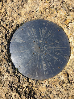
The Inferior Oolite Group can be seen in the numerous exposures along the western facing scarp of the Cotswolds. Composed of up to 100m of oolitic limestones, including the Cheltenham freestone - quarried most extensively at Leckhampton and used widely in the distinctive Regency architecture of Cheltenham, this group is described as soft, yellow, sandy limestone at the base, but gives way to more solid rocks as the sequence moves upwards to thick beds of fine-grained oolitic limestones of the Birdlip Limestone Formation (found most clearly at Cleeve Hill, Leckhampton), which were widely used as a high quality building stone.

Towards the top of the Inferior Oolite the limestones become more fossiliferous and are widely referred to as ‘grits’ due to their coarser texture. Unfortunately, the way the Inferior Oolite is exposed, particularly in places like Cleeve Cloud, as a broad vertical face of stone, it is not possible to appreciate the grip afforded by the exposed grit and fossils but, as I ride by in blur, along the thin ribbons of trail that criss-cross the cloud, I often see climbers taking full advantage of it.

In reality, riding trails in the Cotswolds, particularly if you venture away from the escarpment itself, you’ll most likely, with infrequent exception, experience conditions more attributable to the Great Oolite.
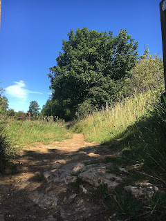

The Great Oolite, sitting above the Inferior Oolite and forming the base to much of the rather barren Cotswold plateau, encompasses a variety of oolitic, shelly, sandy or marly limestone beds, many of which are used for building purposes such as dry-stone walling and roof tiles. Generally paler, off-white to grey, in places varying to brown, and course in texture.

Where exposed, the stone is often fragmented and comes in all shapes and sizes; from dinner plate (and bigger) sized slates with ragged edges and course surfaces, to small, fist sized stones. These loosely assembled pieces of stone are all glued together, mostly, by a sandy, gravelly silt that dries almost as hard as concrete in the summer (before blowing out entirely to emulate beach like sand) but in wetter conditions becomes a killer of components with its grainy, abrasive texture.

Further afield (away from the escarpment, right up on the plateau, the golden hue of the stone has mixed with the overlying muds to create something even worse. Of a sticky, claggy, clay-like consistency and orange in colour, when wet, Cotswold Mud is the devil’s work.

Up on the plateau, there are small areas where traffic, weather, erosion has exposed more of the stone beds; particularly on steeper topography, which leads to the presence of pockets of loose, rocky trails. Away from the escarpment, however, these tend to be isolated sections where the trails are more focussed but, in most cases, the trails and bridleways pass through open fields and common land that undulates with less amplification.

The trails themselves are more indicative than defined and the ground more ‘muddy’ than rocky. This stuff, in wet conditions, will very quickly stick to your tyres, making them appear as though some new form of fat fat tyre and making a mockery of bike design and tyre clearance; eventually, bringing the whole motion thing to an unquestionable halt.

And, you don’t need to venture far from the escarpment to find such conditions. Over the top of Cleeve Common, the exposed trails aren’t too bad but even here, where less obvious, they can become quite messy in winter. However, even where compacted, the binding is more sandy than claggy, and rideable, but venture over to the far side, at the end of the Gallops, and the trails change from the blonde, sandy colour to a much deeper shade of orange. In the summer, these trails ride fine, eventually joining back to the more rocky, exposed trail behind Belas Knapp but in winter they will stop you in your tracks, quite literally.

I quite like a ride to be rounded in terms of trail type, technicality and flow and some of the best routes in the Cotswolds tick all three with blinding sections of singletrack mixed with some wooded loam, some high tech drop ins and flat out rocky descents. I think I tend towards the technical jeopardy of rockier trails compared to mud/rooty trails and, as such, the majority of my favourite trail sections within the Cotswolds are located somewhere along the escarpment and orientated downwards.

From Broadway and Stanton all the way to Cleeve and Leckhampton there are a fair share of rocky descents to pick from but, some of my favourite routes actually venture much further in to the depths of the plateau where peace and quiet can be appreciated amongst beautiful views and serene singletrack. They are, however,  also far more prone to weather and conditions so not as rideable as often.

Snowshill is a good example. Starting/finishing at the bottom of the escarpment, there is myriad choice of great, rocky descent back in to Laverton, Stanton, Stanway & Hailes, to name a few, but the top is just not worth it unless preceded by a few weeks of dry (and warm) weather or off the back of a heavy frost, lest you want to carry the bike for the most of it  (yes, that has happened - i thought it’d get better. It didn’t).

The great thing about the Cotswolds is that no ride is ever the same, there’s too much to choose from to be so restrictive and, no matter what the weather and trail conditions are, they’ll always be a route that works. Getting the maps out and piecing those routes together is half the fun of it (for me, at least) and knowing which routes will work and which are best avoided is simply down to experience and knowledge (I have been caught out enough times from ill begotten ventures down unsuitable trails, only to find myself scraping the clay from the tyres cos they simply won’t turn anymore before eventually giving up and dragging the bike to more suitable conditions, to know where is crap and when).


4 Jan 2021

Trigs and Marylins

Trig points and Marilyns

In Scotland you have Munro’s (see below) and in the Lake District there’s the Wainwrights (include description). There’s the Three Peaks but this would be too short lived and one cannot ride over Scafell Pike anyway, so that’s out the window. What can I do?

I can’t quite recall at what point I came to this way of thinking; only to say it was sometime earlier this year. Although that would be disingenuous, as I suspect it has been a concept growing in my mind for some time. It materialised in to a tangible plan sometime between the end of lockdown one and the start of L.2 - what started off with a blog about my local hill became a fascination with the term Marilyn.

Bredon Hill, Classified a Marilyn - Marilyn: a mountain or hill with over 150 meters of prominence located in Britain, Ireland, and the Isle of Man. The name is derived from a play on words, based on the first name of a famous American actress and the well-known "Munro" peak list of Scotland (www.peakbagger.com).

Compounded by lockdown, a growing disconnect with my bike has fueled the need for a new challenge. A different angle to the rather monotonous fare that makes up my current two-wheeled environment. I don’t want to become just another stereotypical weekend warrior, riding the same trails and bridleways week in, week out; although, that in itself, at the moment, would be a small blessing. I need a significant change of scenery or I need the current scenery to take on renewed light. I am in search of a new challenge or some other purpose to my mountain biking.

For me, the thing about riding local and, in most cases, solo during the initial lockdown and, subsequently, through the rest of the year is that my local trails are fairly tame. In time, they get boring. Although I live not too far from the Cotswold escarpment, it is just far enough to warrant vehicular assistance; thus avoiding the 20km there and back by road. With the exception of Bredon Hill, a Cotswolds outlier, which is in reach from my front door, this was not practicable during lockdown.

By comparison, my local trails, with the exception of Bredon Hill and, to a lesser extent, Dumbleton Hill, are pretty flat and technically, very…. un-technical; and, by local, I mean from my front door (#nocarnognarnotfar) and of a c.10-15km radius. I originate from Winchcombe some 15 miles from where I currently live and I am naturally drawn back to the myriad steeper, more technical trails around the escarpment and those more remote trails deep within the centre of the Cotswolds. Lockdown was pretty torturous in this regard but, as most mountain bikers will attest, I muddled through with what was at my door.

 But, that yearning for better trails has not gone away and, even if you removed the whole Covid-19 blanket from this storey, I’m not sure that renewed riding in the cotswolds would satisfy, as good as it can be. So I did some research. I googled. The nearest Marilyn classified prominences to my home include:
* Worcester Beacon;
* Bredon Hill;
* Cleeve Common;

Cleeve Hill, classified Marilyn

The three above, I have ridden to their summit numerous times. Others I can tick off include:
* Beacon Batch, Somerset;
* Black Mountain, Brecon Beacon’s.

There are, however, many more. In researching, I found that there are several hills nearby that don’t classify despite being taller than 150m. Either due to their not being a single prominence or their prominence being undermined by adjoining high ground.

I started paying attention to the OS map spot heights of my local hills and this has, subsequently, led me down a rabbit warren landing on the noble past-time of trig-bagging.


Whole. New. World

A quick scan of my small collection of OS maps has revealed a new prism through which to view the local landscape. Linking up sections of, otherwise, redundant or isolated sections of bridleway puts a new emphasis on the local trail network and has enabled me to put together some new routes previously untried.

While this may satiate my needs for the short-term, it will be short lived. Once I have ticked off local trig points, those routes and sections of Bridleway will again become isolated and redundant. However, I am planning longer term with this new interest.

So, I’m going to take up trig-bagging and, unlike most ‘bagger’s’, who do so by foot, I am going to use my mountain bike. This will be a key rule - I have to get there by bike.  Many of the local trig points will be easy enough to reach as most lack any really significant elevation but I have no intention of stopping there. My real aim from the start of all this was more aspirational. I want to ride some mountains, which leads me back to the Marilyns.

The OS built some 6500 trig points across the UK. Whilst some 300 have been lost and some are now inaccessible due to their being on private land, some also fall short of the original aspiration due to their proximity to roads and car parks, making them far too easy to ‘collect’. Depending on how well I get on, maybe I will come back to them one day but, for now, my focus will be on those that offer a challenge, in some way or another - be that because they sit atop a significant prominence, such as Snowden summit (1,086m), for example, or simply because I am able to formulate a suitable bike ride that encompasses them. Simply driving up to them and taking a photo feels a bit lame and falls short of what I am aiming for.  In doing so, I hope to collect several Marilyns along the way but I will be starting with those on the Landranger maps I initially poured over - lets ease in to this.


This is the trig point at the top of Snowshill (S5018). It sits along the Cotswold Way between Snowshill and Stumps Cross and offers views of Cleeve Hill, the Malverns and Broadway.

This is the trig pillar at Blakes Hill (S3802), which is just off the A46 at Aston Somerville, near Evesham. It sits within a small fenced copse with views of Bredon Hill, Dumbleton Hill and Snowshill
 

- Ordnance Survey Trig Points: Ordnance Survey Triangulation Station - triangulation pillar is the more formal term for the concrete columns found in the UK, however, the informal term, "trig point", is used more often. Represented by the little blue triangles on an OS Landranger maps. They tend to exist at the high point of a at the top of a

Ben Nevis, at 1344m, tops the list for highest trig pillar.
(wiki).

- Munro: a mountain located in Scotland with a height over 3,000 feet (914.4 m), although Topographical prominence is not a specific requirement, and which features on the Scottish Mountaineering Club (SMC) official list of Munros. They are named after Sir Hugh Munro, 4th Baronet (1856–1919), who produced the first list of such hills; the publication of which is usually considered to be the epoch event of modern peak bagging (wiki).

- Wainwrights: are the 214 peaks (known locally as fells) described in Alfred Wainwright's seven-volume Pictorial Guide to the Lakeland Fells (1955–66). They all lie within the boundary of the Lake District National Park in Cumbria, and all but one (Castle Crag) are over 1,000 feet (304.8 m) in height (wiki).


24 Jul 2020

Talgarth Black - Black Mountains

An Epic trip following a classic route up, over, down and around the black mountains at the heart of the Brecon Beacons. They’re not black or a mountain but they are big and the ride is tough so it’s as good a name as any.

Distance:40km
Climb:1200m
Grade: Black
Time:4-6hours
Rating: 5/5

The ride is accompanied by expansive views, curtesy of some serious climbs and some hooliganously (not a word) fast descents.

The ride is also rich in singletrack and characterised, generally as exposed and grassy. There is very little cover about; certainly no trees and even waist high shrubs are few and far between.

This exposed topography leads to some pretty severe, active scree slopes on the weather beaten sides of the ‘mountains’ and with lots of water sloshing about, some very rocky and exposed trails too. At the top the ground is semi-peaty and will grab a wheel at a moment, if you’re not careful.

We started in Llanbedr and, heading due north, ventured deep in to the nearest valley, following the Grywnne Fechan brook/stream. For a solid hour, we dragged, winched and pushed our way forwards, climbing 364m in elevation over 6km (just under 5%).

Now, as I write that down, it doesn’t really sound much. I do that, and some, on a typical ride over my local hill (not all in one go, mind). Nevertheless, it felt hard at the time. The grassy topography adding resistance to our forward motion and making for slow progress.

The route is singletrack for the most part (the grass clearing away to leave soft earth) but widens out towards the summit in to a grassy causeway. This made tandem riding possible and chatter practicable (who am I kidding).  The climb, as long and drawn out as it was, finishes with a sting in the tail; a final switch back before the last 100m or so. This is the steepest part of the whole climb and foiled 4 of the 5 of us (I thank you).

Feeling a little slow, I had lagged behind my comrades for just over an hour as I sought to pace myself and spread out what little fitness I had (riding time had diminished somewhat over the preceding weeks but I’ve since found out it was partly my brakes were dragging - fucking shitty SRAM pistons); watching them all disappear in to the distance and then fail, one by one, to tackle the switch back gave me time to consider line choice and tactics.

It was time well spent as I cruised past their stricken steeds, spending what ever reserves of energy I had left and powered up the incline; that’s how it’s done - smug feeling awash. I came, I saw, I conquered. I smiled. I got there first, hehe.

You can see the ridge from some 20mins out and it is a torturous progression along the causeway with it seeming to simultaneously edge closer whilst remaining persistently distant. Anyway, having arrived at the top of the pass (still some 100m or so shy of the summit) we were rewarded by one hella good view.  I’d taken my time up the climb and reaching the pass was blessed relief. Time for a snack and to soak up the panorama.

Having gawked and gassed for a short while, we assessed our onward journey - allowing sufficient time for that sense of impending passing-out to subside - before we hit the descent.  We point all point and make vague grunts of agreement at the direction the route takes next. There are no sign posts, just an excessive number of worn-in ribbons of singletrack, heading in myriad directions. We take a punt and head off on one ribbon that looks the most defined, and is heading in the right direction - roughly east. Weaving across the open grassy plains, we (I) take it easy at first (not wanting to look too ‘Enduro’) but it didn’t last long.

What starts off fairly smooth and flowing, gradually got steeper and ‘a tad rowdy’; almost out of nowhere, it just becomes a sea of boulders.  With the addition of large dose of gravity, however, it was less a case of trying to maintain momentum (by picking the right line), over these hefty lumps of mineral, and more a case of just surfing the wave of rocks as you and them cascade down the hill.

Having accurately navigated our way down from the exposed, grassy terrain higher up and safely over the rim dinger that was half way down, the trail changed again. After a brief pause two thirds down for a gate, the trail becomes a high-sided chute;  flanked on both sides by low hanging, scrubby trees and riddled with roots.

The descent brought smiles to all 5 of us. It was worth the climb (The only downside being the shut gate 3/4 of the way down). After a quick regroup, we made our way around the foothills to the north at a more leisurely and social pace; mixing a bit of road, a bit of off-road, a short climb and some swooping singletrack before arriving at what we thought was our next ascent.

We stopped to grab lunch before committing to the next climb, which turned out to be the wrong one (if trying to complete the classic). This route was, in reality a ‘footpath’ (again, no or few sign posts) covering some 320m over 2.5km or less. It gets very steep and leaves no choice but to get off and hike it up. We should have ticked off another few kilometers cycling around the northern foothills before turning to head up using the bridleway but, alas, it wasn’t until we were actually topping out that we realised the error of our ways.

So, as it was, we were left to work our way across the plateau to the top of the next valley. We got a little lost; and stuck a couple of times - the boggy ground happily consuming our front wheels when we weren’t paying attention. We consulted the map a few times but eventually worked it out and found Grwyne Fawr.

The subsequent descent follows the eastern riverbank of the namesake brook/stream feeding Grwyne Fawr reservoir, itself a pseudonym for the loop we were tackling. The ‘Grwyne Fawr’ descent covers some 6.5km and loses about 280m in elevation. It never really gets steep or overly technical but still managed to claim one victim in an over the bars episode good enough for you’ve been framed.

The top is singletrack, intermittently gravelly and rocky and a bit sandy. Near to the reservoir it changes to a wide, grassy/gravelly causeway before later becoming what I can only describe as a street of pitched cobbles. We stopped to check out the dam, which is definitely worth doing if you’ve not been before; we all imagined ourselves as James Bond jumping off the edge to escape the villain. Sadly we all had bikes to carry with us, which would have been an inconvenience, so we stuck with the trail instead.

A bit of road follows, before you hook right in to the trees of Mynydd Du forest. It sounds like a set out of lord of the rings but, trust me, it’s no ancient woodland and there are no Ents to contend with. Just another slog up the various gravel fire roads through thick pine plantations before we emerge out of the tree line no less than a few feet from the ridge line immediately preceding our final descent to Llanbedr.

Like all good trails (classic or trail centre), there is a descent to finish on. It symbolises the finish line. A reward for all the effort paid.  The Talgarth black duly provides with a 3.5km finale following a lovely ribbon of singletrack from the point we emerged from the wooded hillside. Following the ridgeline, initially, with Sugar Loaf in the distance, we track to the right of the summit before us heading around its northern side to follow the contours as they traverse on a southwesterly direction.

The trail has a very consistent gradient; always assisted by gravity but not so steep so as to be over too soon. The Upper 2.5km is just nice to ride. Not technical, not uphill just pure singletrack pointing slightly downhill, allowing an average speed of c.30km/hr.

The direction of the contours and trail diverge and the last 1km steepens. Staying in the open to start with, the defined single track becomes a choice of lines as all before, and, us fight to balance speed with an off camber, curving trail.  on a we all arrive at a gate preceding the final 0.3km at a hell of a click.  Having regrouped we pass through and make our way down the last third of a kilometer through the trees. A short drop to, and climb out of, the stream running behind Llanbedr finishes the ride.

At 40km , the Talgarth black isn’t a killer in terms of distance but it does have a significant amount of climbing 1220m. The location is quite remote and weather can make it a particularly shitty place to be. We rode in early September, however, high off the back of a good summer, which gave us pretty dry trails and reasonable weather.


24 Jun 2020

Covid-19 Update: A mountain biker surviving lockdown.

When Cilian Murphy awakes from his anaesthetic in 28 Days Later and, all groggy and confused, stumbles his way to the hospital main entrance, he is met with a scene not many expected to ever see in this lifetime.

Cities lying empty, streets desolate of people. Society broken, or so it seemed.

Fast forward to 2020; the year that, so far, wasn’t. Just when we thought it couldn’t get any worse (Brexit - I mean that shit just drags on, doesn’t it?), we go and get hit with a pandemic that forced all in to hiding and, some 3 months later, is still threatening our way of life.

Covid-19 has necessitated the most severe restrictions on social and physical interaction any of us are likely to have ever experienced. Living in effective house arrest (your only crime being human and susceptible to the virus) and unable to socialise with others has been an incredibly difficult undertaking.

How long will it last, no one knows; will it ever be overcome, possibly not.

Mountain biking is an inherently social activity. Of course, it doesn’t preclude social gathering; one can ride a bike without needing a group of friends to cheer him/her on from the sidelines; but the mtb community is a social one, nonetheless.

I have written before about the simple, purist joy one can find sharing a ride with friends and, as I alluded to then, riding solo is nothing new to me. Even so, Covid-Lockdown forced the issue and added in to the mix a restriction on movement, meaning not only was I to ride alone but I had a time restriction of 1 hour to boot.

I can’t get anywhere in 1 hour. A ride to my nearest hill - Bredon Hill - and back is a three hour activity. The same applies for the Cotswolds escarpment at Broadway.

I’ve been lucky enough to have stayed in work during this uncertain time so, in between my time spent as a slave (to the crown), a slave (to my son) and a volunteer slave (to my wife), I have been out looking for new and interesting stuff to ride that falls within the 1-hour prescription; I’ve been exploring.

If lockdown has given me anything, it’s a rejuvenated sense curiosity; a desire to actually follow that unknown bit of trail and see where it leads. You know, that bit you always ride past because you don’t know where it goes; because it might be shit and, let’s be honest; because you can’t be bothered.

Everyone has a few fallback routes. Regulars that they can rely on to provide a bike fix. In most cases, however, I am guessing these routes are far removed from the technically challenging stuff we all dream about - we don’t all live in the lakes. As the hashtag goes - no car, no gnar, not far.

Well, with limitations on movement, initially, lockdown has meant a greater demand on those regular routes and, very quickly, their overuse. This has, in turn, led to a growing boredom with these gravel tracks, green lanes and quiet roads. There are some short sections of bridleway I am able to link in, which provide a bit of singletrack, but this is limited and very un-technical.

So, with such restrictions in place and a growing sense of doom at being unable to ride anything more satisfying than a tow path, I have been forced to look harder and the trails around my home town have come under greater significance and need.

Maps have been scrutinised and new routes devised. All that was left was to get out and ride them.  And, I’ve found some pretty good stuff. A lot of which is all within 5-10 minutes of my house. Linking it all together as been fun and, in doing so, I’ve managed to assemble a reasonable loop lasting some 40 mins.

From permissive paths through ancient battlegrounds to elevated Beech groves and sweeping, riverside singletrack, my local trails clearly have a lot more to offer than I had appreciated.

It just goes to show that, with a little curiosity and a willingness to search them out, there are trails there for riding. Most of the those I have found are designated sections of bridleway (and footpaths, in some cases - I know, slap my wrists) that I had simply not bothered with before as they clearly went no where or didn’t link up very well on paper. However, many were also undesignated; simply worn in by use and there to be found physically - not on a map, I’ve had to get out there and explore.

Ironically, even though we are now allowed to drive to locations (in England, obvs) and meet up with more than just ourselves, I still find myself riding the trails I found during lockdown. In fact some of them may well become my new fallback trails. I’ve found my new normal.

Silver linings and all that; thanks Lockdown.


3 Jun 2020

Headspace

20 months ago, I became a father. It was the proudest, happiest, most emotional day of my life.

The immense joy I had at seeing mini me arrive safely in to this world, and the ongoing pleasure I get seeing my little chap grow and develop, is immeasurable.

But, in a seeming attempt at balancing the scales, fate has decreed that, as compensation, I must now suffer a significant reduction in riding time. I can’t have both.

That’s ok. It was hard to come to terms with at first; I knew it would happen but, nonetheless, I was still unprepared.

Watching YouTube clips and Instagram stories from friends’ and associates’ rides, and matching that up to their Strava feeds has done nothing but feed the thought of being left out. I should just put my phone down and block it out but, you know, we all suffer with insatiable appetites for social interaction. Keeping on top of everyone else’s goings on is a huge part of that.

I mean, how can I be influenced if I don’t check out the influencer’s channels.

Anyway, What has actually struck me most since this change in circumstance is not the lack of bike time - although that is very obvious in its absence - but the lack of me time, in general. The importance of headspace. Or, more specifically, the ability to engage with it; or the time to, has become very prominent.

I can’t say the same for everybody (I’m not a psychologist) but I know from personal experience that not having enough time to myself can lead to feeling repressed. For some, this may not be a lot. For other’s, time for reflection is a considerable element of their social wellbeing.

Me, personally; I’m like a dog scratching at the door, or holding the lead in front of its owner. I need to get outside. I like it there. It helps give my brain a chance to breathe.

I always find a good bike ride allows my consciousness some time off, giving my unconscious thoughts the room to grow. In a creative capacity, this can be very liberating. With my brain left to undertake base functions only, such as breathing (literally), there is more room to breathe (figuratively); and space for ideas to bloom.

I have had some of my more creative thoughts whilst in the midst of a hard as f**k climb up whatever hill I’ve decided is the days torture.

Before M arrived, I would ride 2 or 3 times a week, averaging 30km a ride (2-3 hours a time). Some might say this isn’t actually a lot but it was enough for me. Since M arrived, however, this has dwindled to the point that between Christmas (2019, in case you were wondering) and the end of April, I’d been out once on my bike.

Babies/children take up a lot of time; so much so that it can be hard to find the time or space to think about anything else. You spend 90% of it trying to prevent them from killing themselves and the other 10% trying to calm them down after they throw a Hissy fit due to your interventions.

Since his birth, I think I’ve been so engrossed in this little being, that requires all the help I can give him to survive, that I’d sort of forgotten about myself and, in the midst of his arrival, getting out for a bike ride became difficult; so I took up running.

However, running is is nowhere near the same (for me) - for a start, I’ve found it is a lot harder to get rid of an ear worm whilst running than it is out on the bike. Seriously, if it’s not Hey Duggee, I’m humming the theme to Mr ‘effin tumble, constantly - but it does help with head space.

I have found proper mountain bike riding time hard to come by, which itself is depressing at first. I have, simply, had to revise how and where I get my fix for the time being; linking up local bridleways and gravel tracks to create half an hour of off road freedom still provides a break for my mind.

I can vary the routes, to mitigate boredom, but they’re not hugely technical and not really that interesting. The important thing, however, is the ability to get lost in my headspace.

When I’m on the mountain bike, it doesn’t really matter where I’m going. I’ll happily ride to the shops (the long way round, obvs) if it gives me a chance to draw breath.

Babies demand 100% of your attention and energy most of the time; whatever is left is usually reserved for a cup of tea (which inevitably goes cold) but there are ways to get some headspace, if you are willing to compromise and determined to find solutions.

Mine is on my bike and, thankfully, it’s always there when I need it.


16 Apr 2019

Am I Lost?

I have spent many years in search of riding Nirvana.

I say searched, which raises visions of some expansive and adventurous endeavour but I have not actually tried that hard. It sounded good as a tag line but, actually, what I’m looking for doesn’t necessarily require much geographical movement (other than the pedal power obvs’) or literal searching.

By Nirvana, I don’t mean the ultimate trail or location; I’m talking more psychologically. A particular place in my mind, where I find happiness and contentment. Counter-intuitively, this is not as simply achieved as just getting on my bike and going for a ride or finding some ultimate trail; but it is a great place to start!


Mountain biking has a well renowned ability to restore peace of mind to those mentally wearisome, acting as a medium for the enjoyment of the great outdoors. It can free your mind of the daily problems and give your grey matter a chance to re-charge. The simple, raw need to process the requirements resultant of your physical exertion can place otherwise distracting issues to the back of ones consciousness, allowing for more freedom of thought.

Mid climb is actually where I have some of my best ideas - be they a design for a new house i’m working on or decisions that have become all-encompassing. On the bike is a great place for quiet contemplation.


Be it racing, messing about in the woods or arbitrarily passing through the countryside on a warm spring/summer’s day, Mountain biking can be the conduit to a healthier mind and body (Yes, that’s right. It also has a great ability to make you physically fit and healthy, fancy that).
Originally taking up mountain biking over 20 years ago on a fairly bog standard (but I loved it) Universal hardtail (full-sus didn’t really exist back then) with narrow bars and steep angles (everywhere), one of the aspects that really struck me was the freedom I felt as we headed out from my local village and up in to the hills. For this, I have 2 Uncles and an Aunt to thank who, swallowed up by the late 80’s surge in mountain biking, would set upon themselves the responsibility of looking after me and my two cousins every weekend for a few hours by taking us on rides up in to the hills surrounding Winchcombe, in the Cotswolds.

From this, my passion for mountain has grown ever since. With it an appreciation for all forms of the sport/discipline. Be it a mammoth xc ride or a Downhill session to Freeriding and Enduro. I have even tried jump parks. I simply like riding my bike. Alongside this, I have come to appreciate the carefree, peace-of-mind that comes with it and have become increasingly aware of the benefits it harbours.

I have become more aware of this feeling over the last few years but, due to its absence more than anything. It feels like something has been missing?

There are many different ways of enjoying bikes and no ride is ever a bad ride, as they say; even the bad ones. But no-one really remembers their weekly night ride, or their Sunday morning local. It’s a bit like comparing your evening dinner with going out to a michelin starred restaurant with the wife. Only one winner right? Your local ride is a snack compared with the banquet that is a weekender with the mates. Memories are made through shared experiences; from days on the bike that include your friends and acquaintances.


Like a sinusoidal graph, my life riding can be mapped out in a similar way. I have spent large chunks of my life somewhere between the median line and the lower half of the curve; riding solo. Of these rides, I remember very little specifics. Sure, I can remember all my local loops, I know them like the back of my hand. In the same way, I know what Spaghetti Bolognese tastes like but I couldn’t recall one Bolognese meal from another; they all blend in to one collective memory.

Obviously not every ride is a solo and whilst there have been times of plenty, these have been less frequent than the former. The peaks on the graph are a more acute than the more rounded, lower half; Whilst fewer in number, they represent the vat majority of my riding memories. They represent periods in my life when I was more carefree and at greater peace of mind. It’s great to have riding buddies.


The biggest spike would be a period of some 2 years between 2000 - 2002: sixth form. With a good group of friends, some of whom still are, and lots of free time, memories were made in abundance. After this, life just sort a got in the way. Another spike would see me out on a regular basis with siblings and in-laws over a few years around 2005 - 2008.

During all this time, I have stayed in touch with those pals from sixth form (and I still have siblings). We manage to meet up on a fairly regular basis - usually on Wales trips or other trail centres. Not necessarily often, but regularly. From c.2013, I was fortunate that a few of them moved back to the area and, there followed, another really good patch. We had at least a year or so of weekly group rides. Another spike on the graph.

Over the last few years, however, those friends and family members have moved afield or become burdened with the responsibilities of adulthood or simply lost interest in mountain biking. I myself have recently taken on some of these responsibilities, with a lovely bundle of joy waking me up every night. As such, it has been vastly more difficult to ‘meet up’ and I have therefore, found myself lost in the wilderness. On my own again, riding solo.

During this time, I have found my own motivation fading. There is only so much soul searching that one can take before it just gets boring. I have tried to arrest this decline and reinvigorate my interest by introducing fresh challenges. Strava bashing my local hillsides helped for a short while but that soon wore thin. Having taken the KOM on all the descents (not really interested in the climbs), the interest began to fade again.


It has become clear to me that the social aspect of mountain biking is a crucial aspect in satisfying that little part of my brain that finds happiness and contentment from riding a mountain bike. It’s not just the trail, or the view, or even the bike I’m riding. It’s who I’m sharing it with. Of course, the other bits helps but the friends top trumps every time.

Eventing has become my most recent attempt to test myself. Mass start, endurance type events where the challenges themselves are technically and physically demanding. However, as tough as these events might be (maybe I am just unfit), I found them genuinely more intriguing as a social construct. These events have really hit the mark. Its like taking a quadruple espresso shot when all your used to is decaf tea.

In 2016 I completed the HONC [link here], a local endurance ride through the Cotswolds. In 2017, I added the Dyfi Enduro [link here] to that roster - that was mint and one of the classics. In 2018 me and my longest serving biking buddy, and defacto best mate, took on the Mendip Murmuration. Another mass start type endurance event serving up 57km of singletrack across the Mendip Hill’s, including Cheddar’s infamous Gorge.

Here’s a link to that particular days enjoyment (insert link). Lots of climbing, including one particularly bug hill; One of the hottest days in English meteorological records. My best mate by my side. Oh, and shit loads of descents too, of course. Perfect.

This kind of stuff has tested me. Tested my stamina, my attention. It has engaged my brain and served a thick portion of whatever it was that that particular place in my mind, where I find happiness and contentment, wanted for tea. Next up is the Malverns Classic Enduro. Bring it.

14 Apr 2019

Mendip Hills & Cheddar Gorge

Mendip Hills; Cheddar Gorge (Mendip murmuration)

Length: 57.4km
Climb: 1,688m
Grade: Red/Black
Time: 5 hours
Rating: 5/5

Mendip murmuration

Something different; a change of scenery. Something to test my limits… of endurance, if not skill level. Or maybe that too. Something to reignite my passion in mountain biking, which is in the midst of a bit of a lull right now; Am I just unfit and suffering the consequences or has everything just got boring. Surely not, right?

A circumstance not helped by a winter that dragged on for so long I was beginning to forget what summer (or even spring) actually felt, or looked, like. I understand that statement sounds ridiculous after the summer we then had, how ironic. At the time, however, we had just come out of the winter from hell. All nicely rounded off by The Beast from the East.  Last winter was something else.


I don’t normally shy away from getting out in the cold and wet climes of a typical British winter. I actually enjoy it in some perverse, masochistic way and, if all enjoyment fails, riding through winter does at least put you in a much better place come spring to take advantage of those drying trails; and it beats the gym so?

Anyway, winter arrived much earlier last year (2017). I know, I know, its generally the same time every year but we’ve not had snow before Christmas in the Wolds since 2010 (real snow I mean, not a flurry)… [insert image of 2010] …and this time it came twice before the year was out. Then a few more times for good measure. With the longevity of shitty weather that ensued, enthusiasm simply fell away. To make matters worse, in February I came off my bike (or was blown off) whilst attempting a manual off the top of North Hill in the Malvern Hills. This was not a great idea and it tore one of the Rotator cuff (shoulder) tendons.


Careful rehab meant I was back up and running, so to speak, by the summer and, oh boy, what a summer. In the middle of June, me and Ash ventured down to Somerset to take part in the Mendip Murmuration; an event ran by Channel Events as part of the National Trust Top of the Gorge Festival held, obviously, at the top of Cheddar Gorge. The ‘murmuration’ being a 57km endurance ride through the peaks and valleys of the Mendip hills, including the escarpment of the Gorge itself.

From the top of the Gorge, the route took us west over to Charterhouse, before heading north and east to Beacon Batch, the highest point of the route. From here, we were eschewed through Mendip Lodge wood, Rowberrow Warren Wood and down Longbottom on a meandering path towards Hale Coombe. This included 3 genuine descents of over 150m elevation loss, which meant 3 climbs of equal gains; a sign of things to come.

The route was very up and down, making good use of the rolling topography, which was great for my legs. Taking in 4 named peaks (Beacon Batch, Crook Peak, Loxton Hill & Wavering Down plus the Gorge escarpment itself). From Hale Coombe, the route headed over to Compton Bishop, via Cross, before ascending Crook Peak in what felt like quite an arduous endeavour.

Mendip Murmuration took place right in the middle of the melting pot that was last summer. On this particular weekend we were being blessed with temperatures in the high 20’s. With a cloudless sky, the exposed western flank of Crook Peak became a bit of a slog. At only 150m it is not actually that high (relatively) - I climb hills of greater elevational change on my local trails - and, having tackled only c.350m elevation change so far, on paper this should have been fairly easy. In hindsight, it wasn’t actually that bad but I could feel the pain beginning to build.


We were already committed to the ‘long’ route however, so there was no going back. I am glad we did, however, as the view from the trig point was very impressive. Panoramic in the fullest sense of the word. Views back to Axbridge and Cheddar to the East and distant views of Wales over the Severn estuary to the west. To the North, you can see the M5 snaking its was back to Bristol and Wavering Down, which we circle back to later.


The descent off the west side of Crook Peak was cool (watch out for riders practicing their summersaults here, they’re everywhere); some big rocks. Singletrack weaving initially off the barren hillside in to dense gorse shrubbery. Fast. Eventually spitting you out in the village of Webbington. We then pass beneath the M5 and head towards Loxton Hill.

The climb was another short and sharp, 150m or so, ascent. My legs starting to feel the pain at this point. My crash earlier in the year, and subsequent lack of training coming sharply in to focus. No more so than on the next descent. We reached the top in reasonable condition. The fairly mellow gradient helping in that regard. My riding buddy, Ash, is fit as a fiddle and zipped up in no time. I, on the other hand, took my time.

The descent that followed was fast, untechnical and straight. And great fun. The chance to off the brakes and pin it was a huge relief to the lungs and, rather than take it easy I saw it as an opportunity to go flat out. At c.1.5km it didn’t last forever but it did linger in the body. A combination of a reasonably high pace initially, a ridiculously hot day, lots of climbing and a poor salt replacement strategy meant my legs were in a bad way and, as I alighted my bike at the end of the descent, both Quads and Hamstrings decided to cramp at the same time. I hopped about a bit, tried stretches and thought better of it before just resting until it abated.

A relatively flat cruise for the next 8km really helped and the muscles got back in to line. I was nursing them, it has to be said; spinning, to get the blood flowing and the lactic acid out.

To a point, it worked.

That point was the very next climb, obvs. This was the first proper challenge to my fitness (and quite a few other’s too, apparently). I took to walking to try and conserve energy and give my legs a rest. The cramp lurking just beneath the surface like a croc in murky water. My legs were simply not fuelled to tackle such a challenge on a day like this. At 42km, this was about the limit of how far I normally ride on my local trails and so, from here I was in foreign ground. It was baking, literally, and stupidly steep. I recall thinking to myself at the time that we were doing it the wrong direction.

In hindsight, I realise it was simply a precursor to an even bigger challenge. Wavering Down. Getting to the top of this was hard. The contour lines came tightly packed at this point and rather than go round, we were going right over the top. Nursing my cramping legs again, I took my time reaching the summit but, upon doing so, I re-engaged my downhillers brain. I was at the point that I didn’t really care and I was going to enjoy the descents, whether it killed my legs or not. This was a test of mental attrition as anything else.


The descent off Wavering Down was mint. From wide open Common land, with tracks everywhere, the options gradually reducing to one or two lines as we entered the woods. With the ground so dry, the lattice of roots that littered the floor did little to slow me down. Pinning it in to the feed station my legs decided to have another dance, while I rolled about on the floor. From here we re-climbed towards Longbottom before heading south, weaving between the Callow Hill and Batts Coombe quarries. There was a really cool bit of downhill that traversed Shipham Road. It was short but very sweet.

At this point I was actually on my own as I was having to nurse my legs with even greater care. Wierdly, I then caught my friend up at the bottom of the Batts Coombe descent, just on the outskirts of Axbidge, as he had succumbed to a puncture. Rather than stop, I continued to gain some time on him. He caught me back up a few kilometres later at the top of next climb; another 200m slog, which I actually managed to ride up, surprising myself. The lactic acid finally giving way a little.


We completed the last few kilometres together, rounding the top of The Cliffs and heading over the open pasture land before descending back down to Cliff road. At the top of Cliff road, we had one last click of uphill before we reached the finish line.

I took on the Mendip Murmuration, not least for the challenge. However, I have always wanted to ride through/over Cheddar Gorge and the Mendips; driving past on the M5 on our fairly regular pilgrimage to Cornwall and Devon for our holidays (and Uni), they stood out like a beacon and compelled me to click purchase. Having my best mate with me was a bonus. This was a great opportunity to do so.

I actually came across the event one day in 2017, whilst searching the ’net for something new to test myself. Fresh from completing the Dyfi Enduro, and high on the dopamine it left
coursing through my veins, I was keen to testmyself again; and this really hit the spot.

The trails were fairly typical of the UK, mixing high, open common upland, typified by dry, sandy soils and grass grazed short by the roaming agriculture, with rooty, deciduous woodland, rich in detritus and thick with earth. Nowhere was particularly rocky (except for the top of Crook Peak), and the descents were not physically demanding or technical. It was also really dry, so a bonus there.

The changes in elevation were also fairly typical of middle English mountain bike country. Nevertheless, the Mendips delivered. On some level, this had something over my local trails. Maybe the fact that there were c.300 participants and it was one of the hottest days of the year; I don’t think it was as simple as that. The Mendips are just a classic location and they didn’t disappoint. Period.

Having the benefit of a way-marked route through unknown country meant we didn’t end up lost down a dead end trail to nowhere and we were offered up a nice mix of classic bridleway and private trails. I suspect there are better pieces of trail hidden away but this is a bit irrelevant. The Murmuration picks out some of the key local markers, as would be expected of such an event, and serves them up with decent trails in between. What I saw, and anticipated, when driving past on the M5; I rode it in the Mendip Murmuration.